Okay, these images are from our second day at Hocking Hills State Park. As I write this, we've moved on to Starved Rock State Park in Illinois. I'll tell you more about that in tomorrow's post. For now, I'm catching up on the days we were without internet. Our cell signal here is weak, and so I'm only hoping I can get my pictures uploaded. Let's just see about that right now, shall we? Here we go.
We started at the Cedar Falls trail.
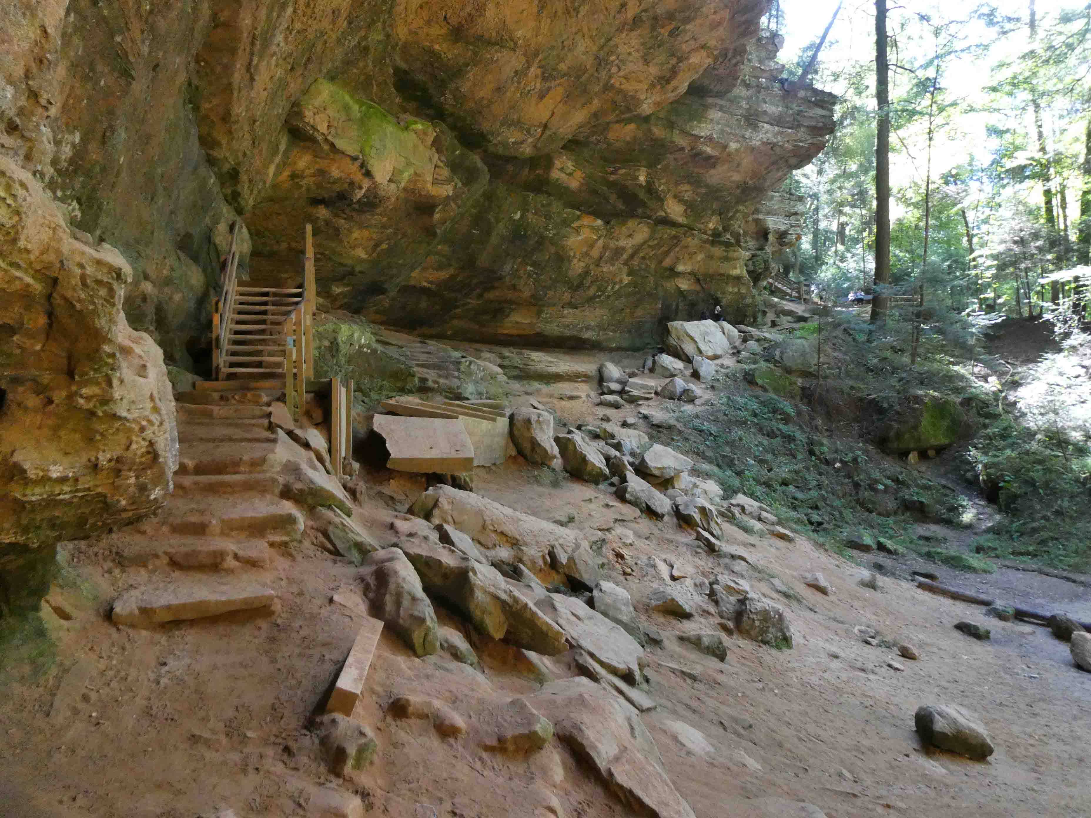
Stay with me my friends. It would be easy to take a tumble here.
Each of the hikes we did in this park led into a "gorge." These areas were not carved out by glaciers, but were instead formed when the Wisconsin Glacier began melting. The glacier stopped in northern Hocking County, so the area suffered indescribable flooding when the melting began. The ancient Teays River was buried under tons of glacial silt, and the direction of the Hocking River was reversed.
When the glacial torrents found cracks in the hard capstone, the water poured through to flush out the soft middle layer. This left long tunnels where the gorges are today. Eventually, the weight of the tops caused them to come crashing down. The "slump rocks" in the gorges today are what's left of the hard top layer. In just a few centuries, the rushing waters of the glacier carved the soft middle layer of sandstone into the myriad dimples and wrinkles that decorate the cliffs and grottos today.
Early settlers in Muskingum County found an ancient black human handprint on a cliff that is part of this same sandstone formation. That is the same "black hand sandstone" that is seen in six areas of Hocking Hills State Park. And as we go, remember that these trails are the work of the Civilian Conservation Corps...my favorite government agency, no longer in existence.
There is a lot of moisture in this park, and you'll see it in the form of fungi, moss, and ferns growing on many surfaces.
As we walked along, I gazed upward to see the black hand sandstone cliff.
Here is some signage explaining more about how the area was formed.
Here's another look at the cliffs.
Looking here, you can see the moss growing on this stone wall.
On the other side of the bridge, ferns and moss growing, seemingly, from solid rock.
Looking back at the bridge, it looks like this.
Here's some information about Cedar Falls. There wasn't a lot of water flowing so late in the year.
And here's the waterfall.
Mike was interested in how the stream split apart and then came together just as it fell from the rock.
I had a short video to show you of the waterfall, but I'm not able to upload it with my internet connection. I'll try again at our next stop in Dubuque, Iowa.
From here, we had to climb up this wood staircase to get back to the parking lot. It was less difficult than it appears.
It was another one-way trail with some narrow areas where hikers going in opposite directions would have trouble passing one another.
In this next image, I wanted you to see the horizontal layers of sandstone.
The stairs cut into the rock are there thanks to the Civilian Conservation Corps.
It appears as a maze of rock, but the trails were very easy to follow.
From there, we headed to Ash Cave. It was a huge overhang similar to Old Man's Cave.
This was a trail built to accommodate the needs of folks with mobility issues. It was a loop trail, but it was also possible to make it an in-and-out trail for those riding scooters or wheelchairs.
Looking up, we could see another example of the rugged cliffs and black hand sandstone.
It's name comes from huge piles of ash that were found here. Initially, there was speculation about what caused the ash. Sifting through it, they found bits of pottery and animal bone, and so it was obviously human caused.
These next several images were taken standing in different parts of the cave to give you some idea of the size.
In the next image we're looking back in the other direction, as we began to ascend the trail back to the parking lot.
And more stairs and an uphill climb led us back to the parking lot.
We enjoyed this area very much. The cliff formations were unique and different from anything we've seen previously.
I'm hoping I'll be able to upload this post. I have a weak cell signal, and no wi-fi. Since I wasn't able to upload the video, I'm a little worried about these pictures. There's only one way to know...here we go.


7 comments:
Only spread a fern-frond over a man's head and worldly cares are cast out, and freedom and beauty and peace come in. ~ John Muir
I'm really enjoying your hikes, as you seem to hit some very interesting trails. There is a trail around here in a state park made by the CCC and I'm amazed at the precision of the steps. They used to be easy when I was in my 30s but in my 70s they have suddenly turned difficult!
That looks like a really cool park!
This is such an interesting geological area. I’ve not seen this sort of structure, if I have, the signs would have been needed. My imagination took over while reading this. It went from the first settlers observation to the native peoples using the cave for shelter. Imagine what time of year they would live here. Summer? Winter? Likely not during the spring thaw.
Thanks for the view of this area.
What a fun place to explore! The waterfall and the way it splits is fascinating.
This section looks like it must have been a fun hike and how gratifying to know that there are accessible trails. Too bad there aren't more of them.
Thanks so much for taking this gimpy gal along the trails with you, I do appreciate it SO much!
Take care.
Post a Comment