Let's get in the time traveling machine and travel back three days to when we arrived at Hocking Hills State Park in Ohio.
It was a fairly primitive site, although we did have an electrical hook-up. There was no wi-fi access, and we couldn't pick up satellite TV. Also, our site was small with a pair of barking and howling dogs next door. They were in one of the tent trailers, and their owners had left them behind. They were making quite a fuss at virtually anything that moved. The kitties were extremely offended at such rude and immature behavior.
It was late in the day, but we knew we were just yards away from access to the trailhead for Old Man's Cave. And hey...Mike is an old man. We ought to be able to do that. It meant traversing a steep slope from the campground to the visitor center below. We passed through a forest comprised mainly of Eastern Hemlock. (We have Western Hemlock in our woods at home.)
Eventually, we crossed over this "A-frame bridge."
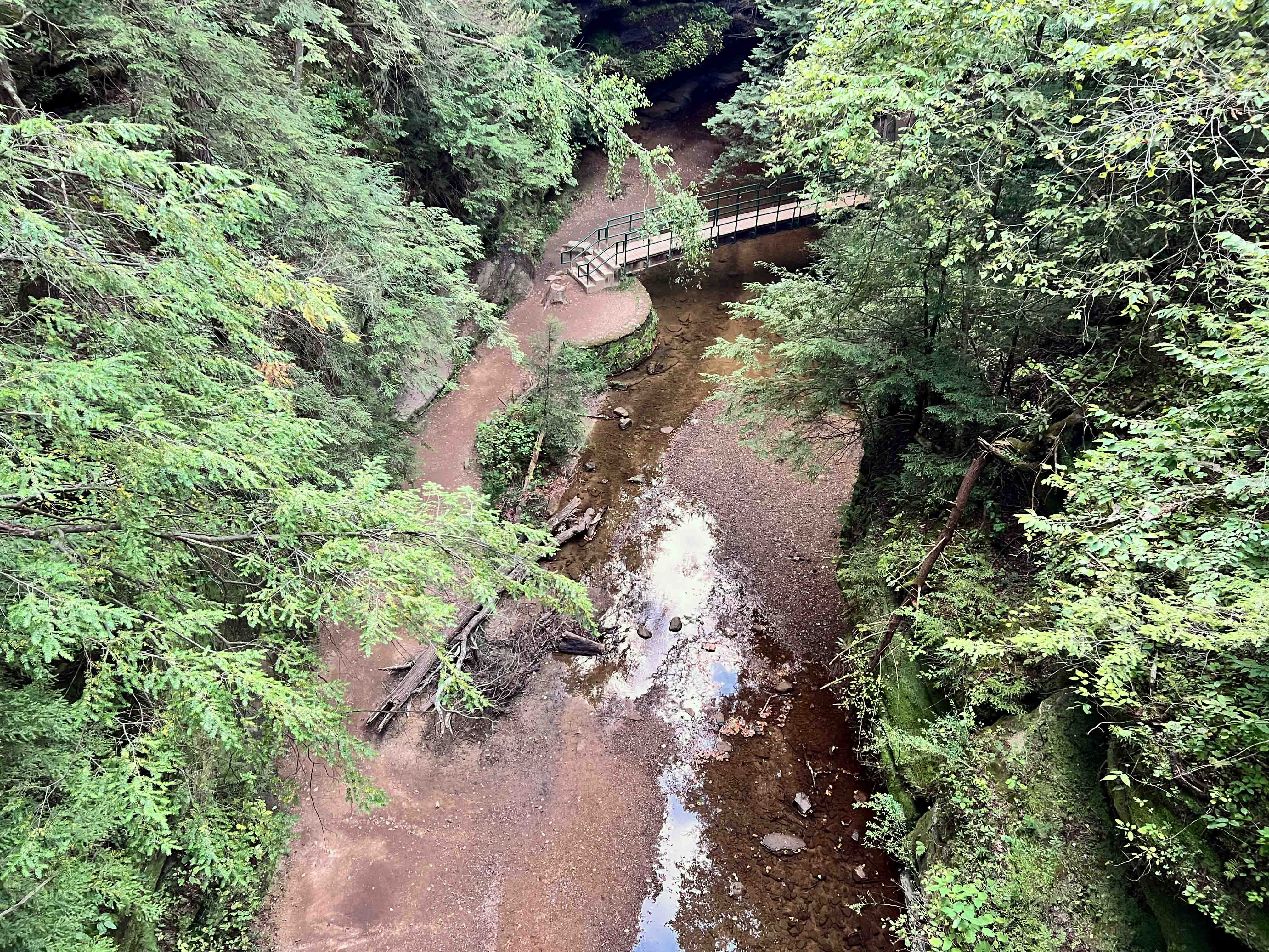
Looking to the left, there was a creek running and another bridge below.
In the other direction, stone walls and walkways.
Eventually, we arrived at the trail. Here's some information about it and the origin of its name. If you want to know more about the cave, then
click right here.
We could have walked in several different directions, since this was the convergence of a few different trails. All the signs said the same thing: "Exit Only. Wrong Way. Do not Enter." And this made no sense to us. How can a trail be one way? Unless one is riding a bike or a horse or something. On foot, it didn't make a lot of sense to us. We just walked on...rebels that we are.
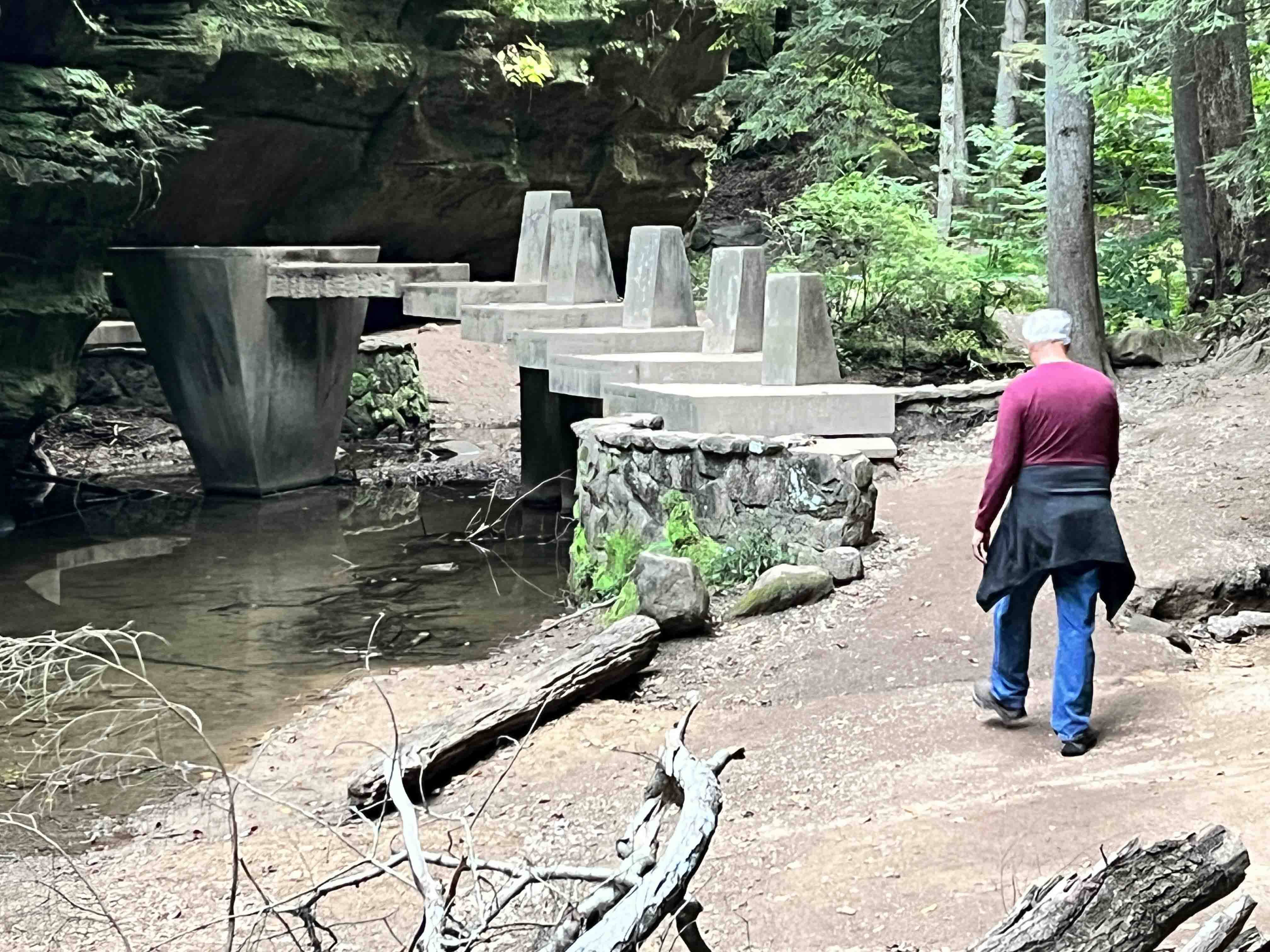
As you look at these pictures, keep in mind that the stone steps, stone walls, stone walkways, tunnels, and bridges were all built by the Civilian Conservation Corps (CCC).
The "cave" was really an enormous overhang of blackhand sandstone. Oh, and look! There's the old man now!!!
Standing there, we could look across the creek and see where we'd be walking next. In the middle of the image below, you can see the stone bridge we would cross.
It meant walking down these stone steps and through a tunnel.
Yes, this too was constructed by the CCC.
Looking back to where we'd come from...
I'm always intrigued by tree roots growing over huge boulders. Where there's a will, there's a way.
We crossed over the stone bridge.
And through a second tunnel.
And, yes, we were still going the wrong way.
We began to understand why it was one way, however. Some of the walkways were only wide enough for one person to pass by. In some places, the rock overhang was so low, we had to duck. It would have been difficult to pass by another hiker going in the opposite direction. Fortunately, we seemed to be the only people on the trail.
Here, these steps appeared more modern, but there was no indication they were built by anyone other than the CCC.
Here's one of the narrow parts of the trail I mentioned.
Here's some information about the "Devil's Bathtub," and a picture is to follow.
It looks inviting...no? But please, like the sign says, climbing out is virtually impossible.
It was fed by a waterfall up the creek. Notice another stone bridge in the image below.
We were near the end of the hike here, and found another sign with a little more information about the waterfall.
We finished the hike at the visitor center, closed that late in the day, but found this information about the Sphinx Head.
I can't say we saw it, but I did appreciate the art work.
Okay, and it was getting dark then. We needed to make our way back to the campground before the sun set, or risk getting lost in the woods. We had to make our way back up the steep slope we'd come down, and then we called it a day.
I still have two more hikes to tell you about, but we're getting ready to take off from here and make our way to Starved Rock State Park in Illinois. More later. Fingers crossed the jacks and slides operate as they are supposed to.


8 comments:
You can't turn back the clock. But you can wind it up again. ~ Bonnie Prudden.
What a beautiful trail, cave, devil's bath. It looks like a great State Park. I'm glad you were able to explore here and share it with us. Thank you.
What a fascinating and beautiful place!
Thank you for taking us with you down this trail, so beautiful and it reminded me of my favorite book “Clan of the Cave bear” by Jean M Auel.
Grammar!! Was the old gentleman a part of the state park? The sign clearly states he was :D Gorgeous place!
It's funny you found the wrong way signs, wonder where the correct ones to take you on your way were?. The Devil's Bath looked rather frightening, makes you wonder how many people have jumped or slipped in and needed assistance?
Being a rebel is always fun and I suppose if you met anyone on the trail you could always turn around and pretend you were walking the 'right' way. Looks like a fun trail although I wouldn't be too fussy on those tunnels.
WRONG WAY! LOL I remember when my sister & I went to Boston, and trying to drive away from Boston Common, it seemed that all the streets were one-way. We came up to one spot I thought we could go away, but when we got to the intersection, it seemed that all 3 ways pointed back to us!
Those stone bridges are quite graceful. Those young men in the CCCs really did good work that has lasted quite a long time.
Happy Trails!
Post a Comment