For a short trip, we packed a lot in. We were pleasantly surprised by the beauty of the area we visited near Palouse Falls State Park in Eastern Washington this past week. We arrived home yesterday to find the grass and weeds taller, but everything otherwise in ship shape. The kitties were glad to see us, and we were home early enough to let them out for a good run and hunting expedition. As you might guess, I have a lot of pictures to show you, and so there's no time to waste with pleasantries. (By the way...how are you?)
Before we left, the final peony bloomed. This is the Garden Treasures peony. When we arrived home, the flower was still going strong, and there is one more bud on this plant.
We had a long drive the first day (Tuesday), and the weather was absolutely terrible. I caught a few pictures in the Columbia Gorge during the rain breaks. The gorge is recovering from the devastating fires of 2017, but there is still plenty of evidence of the fire. Not all the trees burned, and the underbrush is recovering little by little. Still, high up on the hillsides things are still looking blackened and charred.
It was a surprisingly beautiful setting at the Lyon Ferry Marina KOA near Starbuck, Washington. I'm often knocking KOAs as over-priced and run down, but occasionally, we happen on a nice one. This one was scenic and serene with a bit of history nearby. In the image below, you can see a floating bridge where it was possible to walk out on the river (this is the Snake River). The railroad bridge in the background is known as the Joso Viaduct. Built in 1914, this railroad bridge is 3,290 feet long, built of steel and set on concrete piers. It was once billed as the highest and longest trestle in the world. Cool, huh?
During the last ice age 10,000 to 20,000 years ago, part of a glacier blocked the Clark Fork River in northern Idaho that normally flowed into Washington near what is now Spokane. This created an ice dam that caused the river to form a lake in western Montana. This lake eventually grew to cover 3,000 square miles, containing as much water as Lake Erie and Lake Ontario combined. Then the ice dam collapsed. The water from the lake was released and created one of the largest mega floods in the history of the world. This was first theorized by a geologist named J. Harlen Bretz in 1923. His theory was very controversial and other geologists thought he was nuts. It was not until the early 1970's that his mega flood theory was finally accepted, with the help of NASA's satellite imagery that clearly revealed the network of channels carved out by the mega floods.
Think of it like the ripples you might see in the sand when standing at the edge of the ocean, and then make it on a large scale, and you have an idea of how this area might look in satellite imagery. Here's an example:
We drove across a short bridge to reach the state park. There, we expected to see a stream, but marveled at the gash cut in the basalt to allow the railroad to pass through.
The park was just across the bridge.
We were happy to be the only ones there, which allowed us to enjoy the many yellow-bellied marmots running around and grazing in the grass. I took lots of pictures, but this one was happiest to pose for a good picture of his adorable self.
It was just about 100 yards from the parking lot to where we could view the falls. Watch your step, please.
Looking out...oh my. Very impressive. It was terrible lighting for these photos, and so I apologize for the lens flares in these pictures.
Palouse Falls remains as one of the magnificent and lasting remnants of the Missoula Floods. It is the only major waterfall left along this thousands-of-years-old glacial flood path, and on February 12, 2014, it was designated Washington's official state waterfall. Standing at a height of 198 feet and surrounded by striking basalt cliffs, the powerful waterfall lies on the Palouse River upstream of the confluence with the Snake River.
The rules clearly and boldly stated there was to be no drone flying without a permit. Of course, we had no permit, but we had the place to ourselves for the first half hour of our visit or so. We decided no one would be the wiser if Mike took the drone out for a spin. He hasn't downloaded his footage yet, and so I'll have to save that for a later post. You can see his little drone taking a look-see at the waterfall in the image below.
At our feet, another marmot was tending to something among the rocks. This was on the other side of the fence, and so you can see what I could see in the image below. I have a feeling it's attending to some young.
Oh yes, and you wanted to see some marmot poop, didn't you? It's not as impressive as buffalo poop.
Okay, and so when the drone was put away, we took a little hike around to see a different view of the falls. But first...keep your shoes tied and watch your step because there are lots of ways to die out here today.
While you're lacing up your shoes, you might want to check the balance in your bank account. If you slip and fall here, cost of rescue is on you.
And, really, it wasn't all that scary, but we could see where folks had hopped the fence and left a trail along the steep cliffs. Not this explorer. One broken shoulder per year is all I'm up for. We wandered through amber waves of grain. We believe these are probably wild oats.
We were able to get around above the falls and see where the river was flowing. There were some rapids and a shorter grouping of falls there.
This sign was discouraging folks from scaling the cliffs and trying to get down to the water. Inviting though it was, we weren't even tempted.
It was a pretty good view of the falls though.
And this was the canyon beyond. From here the river flows on where it meets up with the Snake River right near where we were camping.
We could see our rig off in the distance, and a lot more visitors had arrived by that time. We were glad we got there early.
We were there about an hour and a half, and then drove back toward the campground. There was really nothing else on our agenda, but we still made a day of sight-seeing. Within walking distance of the campground we saw Lyon Ferry State Park as we passed by in our truck. We stopped off on our way back. It was a lovely picnic area with a nice restroom and swimming beach. Be careful though.
Enjoying the views with us were some wild turkeys. They were off in the distance. I took lots of pictures, and the one below was the best of the bunch.
Here you can see the picnic and swimming area. This would be a nice place to visit on a hot day.
Also, we got a little history lesson here. Sorry for the lens flares again. The light was impossibly bad for taking pictures.
To get back to the campground, we crossed the Snake River Bridge. It has an interesting history. It was originally constructed in 1927 and known as the Vantage Ferry Bridge, where it carried the North Central Highway over the Columbia River in
Vantage, Washington, replacing a four-car ferry. By 1923, the ferry was transporting 50,000 people across the river annually, and it was clear that a bridge was needed to replace it. Later, the construction of the Wanapum Dam downriver of the bridge in the 1960s flooded the town of Vantage, and state officials decided to replace the existing two-lane bridge, which had become unsafe for high volume traffic, with a new four-lane bridge. The old bridge was dismantled and put into storage. Meanwhile, at Lyons Ferry, crossings of the Snake River were done by ferry, but the construction of the Lower Monumental Dam caused the river to slow, thus increasing crossing time. State officials then decided to reconstruct this bridge at this location. And here it is, as you see it now. I took this picture on our final morning.

Here's how it looked when we crossed over on our sight-seeing day.
It's super narrow. You wouldn't want to have to share it with a big truck, and we're big enough with our dually truck and truck camper.
It seemed like we should check out the little town of Starbuck, Washington. This whole area is a bird-watcher's paradise. We especially enjoyed watching the swallows darting about. Along the way to Starbuck, we found this area where they are nesting in the hillside.
You can
read more about Starbuck right here. It's another town, like so many, that was built when the railroad ran through, only to die out again with changes to the railroad. As it stands today, Starbuck is a quiet hamlet of 129 souls. The residents work at the Rawhide Bar N Grill and Darver Tackle, and many enjoy going to Starbuck every Fourth of July for a fantastic lighting of fireworks.
As we drove into town, we were behind this farmer and his daughter, out for a buggy ride. These are not Amish folk. The garb was all wrong, and their buggy would have been considered too "flashy" for the Amish. We were just charmed at the whole idea of a horse and buggy driving on the main road through town.
It's mainly residential, but the livery stable is still there...just in case you need a place to board your horse for the night. There's an old ambulance parked in the garage.
Also the former "Starbuck Drug Company," now converted into a restaurant.
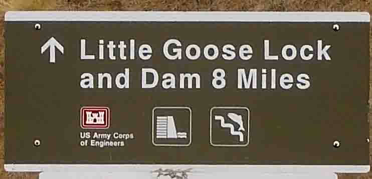
Okay, so that was kind of fun. And then we decided to drive up to Little Goose Lock and Dam. There are some things we simply must explore when we're traveling. Lighthouses and dams are among them.
You can
read more about this project right here, but essentially, the dam is 2,655 feet long with an effective height of about 100 feet. It is located on the Snake River upstream of Lake West, the reservoir formed by Lower Monumental Dam. It is a concrete gravity dam with an earth fill abutment embankment. It includes a navigation lock and eight-bay spillway that is 512 feet long.
We were especially interested in the fish ladder. This was a huge structure. Looking left, we saw this:
Looking right, we saw this:
And right beside me, the fish ladder where one might see fish jumping at the right time of the year.
It was possible to walk inside and see the fish.
Here's a portion of a sign explaining how this whole thing works to benefit the fish.
We didn't see a lot of fish, but according to this sign, we were visiting during prime Chinook migration season.
Okay, so that was an interesting and unexpected diversion. On the way back, we paused at an overlook so you could see the enormous stacks of baled straw. We were in a section of The Palouse here. I've written about The Palouse before, and you can
read an old blog post and see pictures of the area right here. It's another natural wonder caused by the Missoula Floods and it's one of the largest wheat-producing regions in the world. With all the wheat, there is a lot of straw. Here, we learned the straw pulp is processed into "treeless paper." You can read more about the process of turning wheat straw pulp into paper
right here. You can see the huge stacks of baled straw on the left side (behind the trees) in the image below.
And this was just one of many areas where bales of straw were stacked. It seems they've gotten behind in processing during COVID as the plants have been closed for the past year.
Back at the campground, we noted trains cross the bridge every couple of hours. They are moving slowly here, and so there was hardly any noise...just a low rumble as they passed by.
Here's how the bridge looked at sunset.
Our shadow selves were feeling pretty darned spunky after a day of sight-seeing. They were ready for some relaxation the next day.
We didn't do much more after that, and we spent all of Thursday relaxing, sitting, stitching, napping, staying-hydrated, and walking around the campground. There weren't really any blooming things to speak of, but near the river, I spied these little guys. They are about the size of a nickel.
Also, these growing in a tree. Mike thought they were crabapples. They were about the size of a cherry.
Then, Friday morning we headed for home.
The first half of our distance was through this section of The Palouse where there are wheat fields, corn fields, grain elevators, and plenty of wide open spaces.
There are a couple of places along this road where it takes you straight at a constellation of grain elevators, and then routes you around, only to end up on the same path as before.
On the right side of the image above, you can see the abandoned structure pictured below. No idea what this once was used for.
As we headed closer into the city, we came around a bend where Mt. Hood came into view.
It reminded me of a time many moons ago (1978) when Mike and I were moving to Oregon from Phoenix, Arizona. As we came around this bend near The Dalles, Oregon, on I-84, I caught my first glimpse of Mt. Hood. It was at this moment that I knew I was going to love living in Oregon.
Okay...so that's about it for this trip. Today is going to be a busy day. I simply must get out and hoe the vegetable garden. Erik has invited us for dinner tonight. He says he's going to barbecue the biggest brisket he's ever attempted. He's an excellent barbecue chef (and just generally an excellent cook), and so I'm looking forward to getting a taste of his latest project. My contribution will be a dilled potato salad, and so I need to get a start on that fairly soon.
I've prattled on long enough this morning, so I'll catch you up on kitties and sewing tomorrow. For now, I hope you've enjoyed this little adventure into Eastern Washington. It's a beautiful and historically interesting area. We'd like to go back with our boat at some point so we can explore those canyons up the Snake and Palouse Rivers, but that will have to wait for another year.


17 comments:
Rivers know this: there is no hurry. We shall get there some day. ~ A.A. Milne
This was wonderful, thanks for sharing!
This was very interesting! Who knew wheat grew in Washington?!
Thanks for the photos😀
Spectacular Falls--just an amazing area...thanks for the phot-journey;)) Hugs, Julierose
I love traveling virtually through your camera lens - certainly I'll never get there myself. The falls are beautiful. And that abandoned structure I think must have been a house, just by the way it's laid out. I've actually seen Mount Hood but never from the viewpoint that you have.
Your e-mail 'follow-it' is not coming thru, so I looked you up. Glad to see you gad abouts are enjoying yourselves. Yes, always fun to travel with you thru your camera.
What a fun getaway trip. A lot of beauty and history and just looks like a great little road trip adventure. Thanks for sharing insights and inspiring. Eastern Washington is so different from Western Washington. I think I've only been to the Eastern part a couple of times. Your pictures helped to refresh my memory of the landscape as well as inspire me to go back and see more places. I've never seen a Marmot and would love to see one in nature. Good to know your sweet kitties did well on their own (no wild parties). I'm sure they are happy you and Mike are back home, even though they had a couple of robots taking care of them while you were away. You guys are irreplaceable.
You captured some really incredible photos, Barbara!!
Fantastic!
Just love your travelogues. Takes me right out of my armchair and into your country. Thank you so much again for sharing it all with us.
That's one very pretty peony.
Thanks for taking us on your travels. The landscape is incredible, but then, I remember that there's some wonderful gorges and rivers in NY sate as well, if we'd only get off our duffs and go visit them.
Pat
Lovely pictures…tks for sharing.
I don't know where to start! I've read your blog for years and do my traveling thru you as my husband does not enjoy traveling. You brought back so many memories today with your post. I grew up in Dayton, Washington, not far from Starbuck. My Uncle and his family lived there and he used to hold a rodeo there many years ago. We would go over, was probably not even in my teens at that time (am 78 now). As I remember my mom would run the concession stand. As for the wheat fields and the grain elevators, when grandpa would harvest the wheat he would let us ride in the back of the truck on its way to the elevator and we would play in all the loose
wheat. Would, I'm sure, not be allowed today!
Kept hoping as I read that you would go thru Dayton and post pictures but not, so just want to say a Big THANK you for the memories today!
Hopefully in "another year" there will still be enough water in those rivers for you and Mike to take your boat
Great pictures and information about your trip. I'd love to live in sight of a mountain with snow on the top but I'd have to move to Scotland for that.
Thanks for the tour. We have a small park in the downtown area of our city called Fish Ladder Park. It is very similar to the one you saw and was built for the same purpose.
What a fun post to read - it's like going on a little day trip with the two of you!
I believe that the old building is the school from Clyde, the intersection south of Lyons ferry as I recall. So many places around there we visited when we lived in Walla Walla.
Post a Comment