Good morning, my friends. Well, I told Mike I should have named this trip the Forty-niners trip...49 states, 49 years married. We knew there were no good restaurants ("good," meaning the kind of place you go for a celebration) in Kremmling, and so we decided to have a celebratory breakfast yesterday morning. We started with mimosas, and then moved on to breakfast. Mike had Smoked Salmon Eggs Benedict. I had a really gorpy Caramel Apple Hotcake. Mine sounded better on the menu than it tasted in my mouth, but no matter. It was a nice way to celebrate. We asked our server to take our picture. Here are two people who are much older in appearance than we are in our minds.
Showing posts sorted by date for query Breckenridge. Sort by relevance Show all posts
5/25/24
Kremmling, Colorado
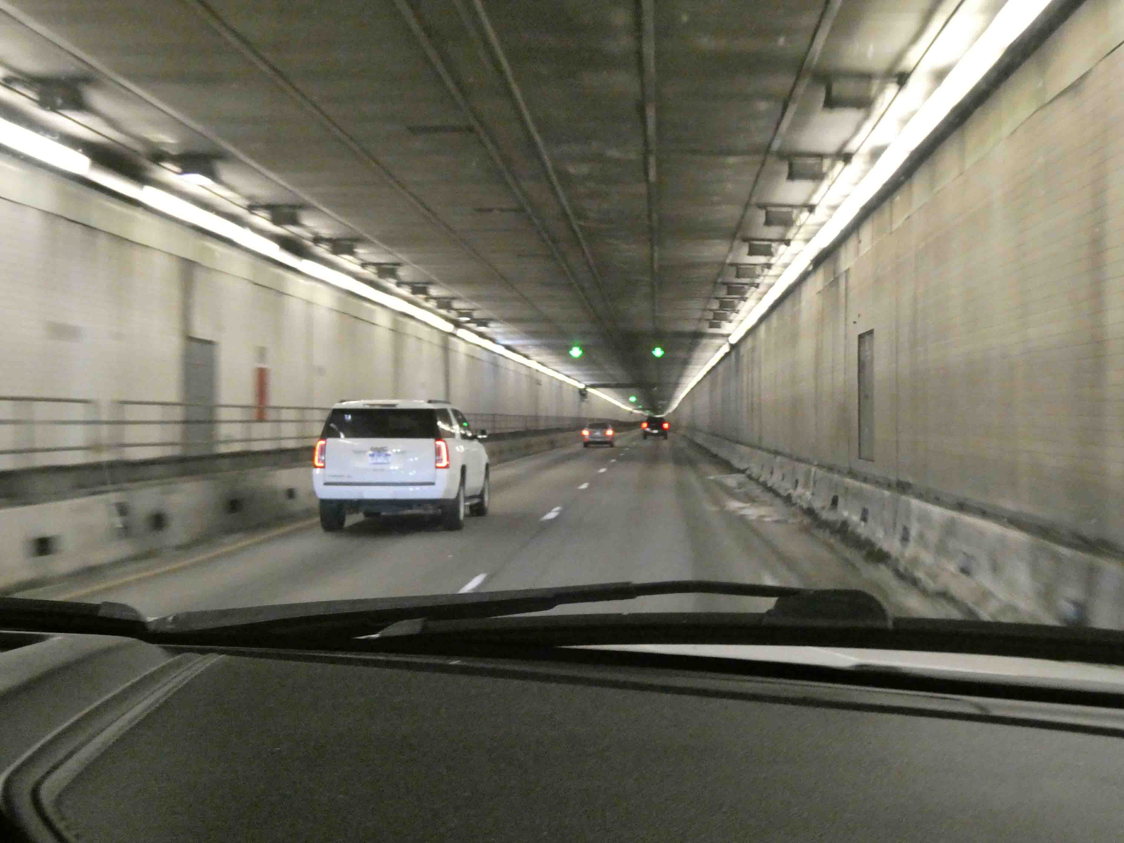
On down the road, we passed through a tunnel right away...and you know how excited we get about tunnels.
On January 5, 1859, prospector George A. Jackson discovered placer gold at the present site of Idaho Springs, where Chicago Creek empties into Clear Creek. It was the first substantial gold discovery in Colorado. Jackson, a Missouri native with experience in the California gold fields, was drawn to the area by clouds of steam rising from some nearby hot springs. Jackson kept his find secret for several months, but after he paid for some supplies with gold dust, others rushed to Jackson's diggings. The location was originally known as "Jackson's Diggings." Once the location became a permanent settlement, it was variously called "Sacramento City," "Idahoe," "Idaho," "Idaho City," and finally "Idaho Springs."
We drove through some diverse terrain to arrive in Kremmling. At times, we drove through rocky canyons that had been blasted out in order to make way for the road.
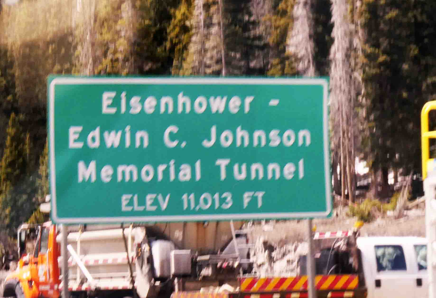
The Eisenhower Tunnel is a dual-bore, four-lane vehicular tunnel approximately 60 miles (97 km) west of Denver, Colorado. The tunnel carries Interstate 70 under the Continental Divide in the Rocky Mountains. With a maximum elevation of 11,158 feet (3,401 m) above sea level, it is one of the highest vehicular tunnels in the world. The tunnel is the longest mountain tunnel and highest point on the Interstate Highway System. Opened in 1973, the westbound bore is named after Dwight D. Eisenhower, the U.S. President for whom the Interstate system is also named. The eastbound bore was completed in 1979 and is named for Edwin C. Johnson, a governor and U.S. Senator who lobbied for an Interstate Highway to be built across Colorado.
Okay, here we go.
At its dedication, the Eisenhower Tunnel was the highest vehicular tunnel in the world. While it remains the highest vehicular tunnel in the US, and longest mountain tunnel and highest point on the Interstate Highway System, higher tunnels have since been constructed elsewhere, such as the Fenghuoshan Tunnel, a rail tunnel in China.
Coming out the other side, we could see the small town of Silverthorne, Colorado.
The town was named for Judge Marshall Silverthorn who served as the judge of the miners' court in Breckenridge. The judge first came to town as a prospector and claimed a section of the Blue River in 1881. After patenting his claim in April 1882, he was disappointed to find the gold to be sparse and the claim a poor bet. The land passed to his daughters on his death in 1887 and was then sold several times to various mining companies.
At the turn-off to Silverthorne, we left the interstate highway and headed up Colorado Hwy 9. We paralleled the Blue River all the way.
It was a quiet night. I despaired at the wind when we arrived with gusts up to 30 mph, but it died down before dinner, and we slept well. We'll be heading for Jenson, Utah, later this morning, where we'll stay for two nights in order to drive the Harpers Corner Scenic Drive in Dinosaur National Monument tomorrow. You might recall we tried to do this on our last visit to Dinosaur National Monument, but it was too far away from where we stayed in Vernal. I'm afraid I didn't plan this stop very well, and we're still a good distance away from the beginning of the drive, but we will persevere. We're tough that way...and besides we're old. These opportunities don't come along every day, and so the time is now.
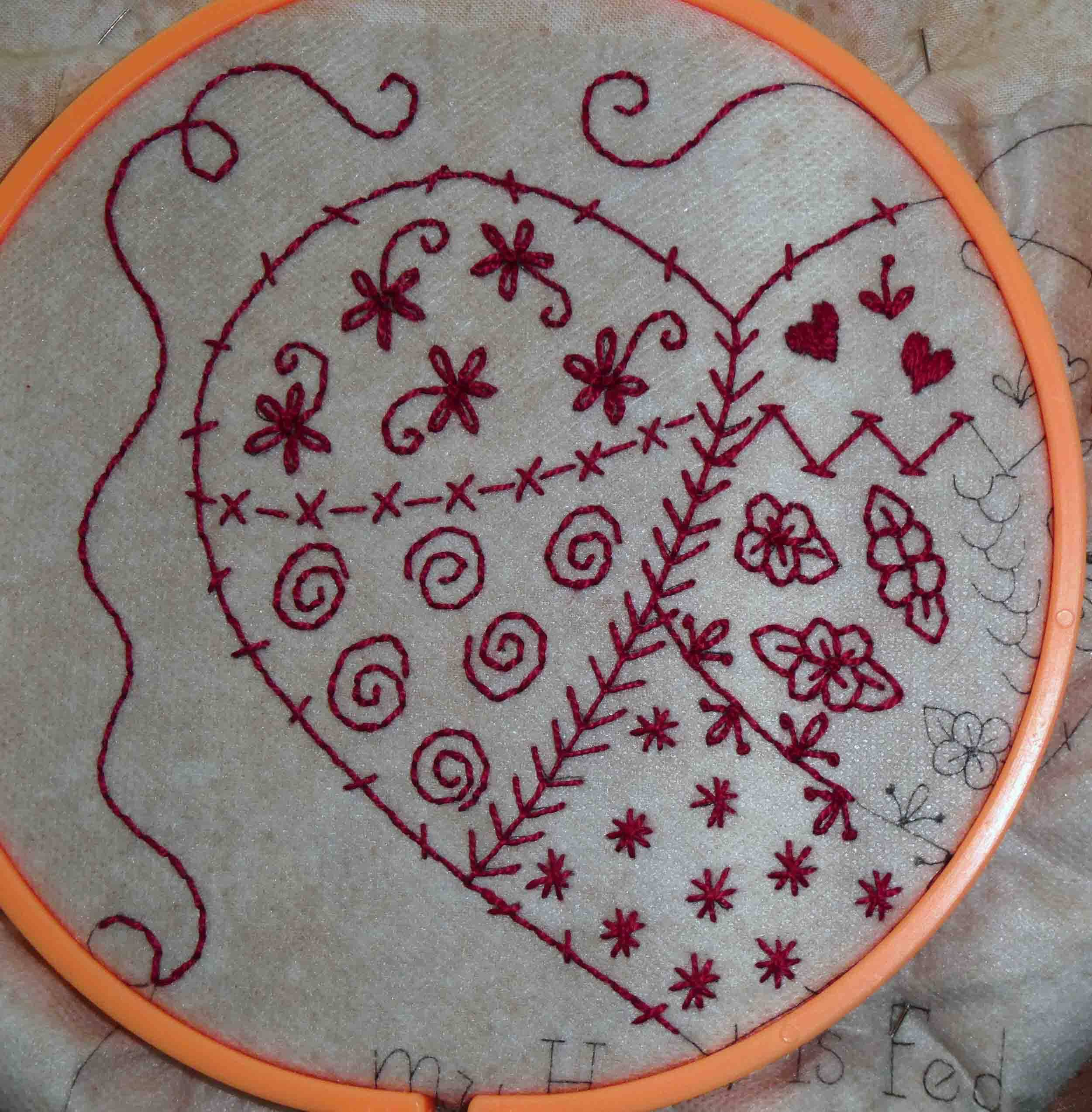
By planning shorter driving days for this trip, it has given us the luxury of slow mornings. This morning is such a morning. I should have a little time to work on my slow-stitching before we get on our way. For now, I'm going to have a bite to eat.
Thanks to those of you who have wished us a happy anniversary. We had a nice day...an easy day...and those are the best kinds of days.
9/19/22
Breckenridge, Michigan
It was a relatively short drive to our newest destination. We were delayed when Smitty refused to get out of bed. He was fairly well crashed out on my side for the morning. It's hard to make the bed when it's in this condition.
It took me four days to hitchhike from SaginawI've gone to look for America.
When my Facebook friends starting chiming in with their own lyrics, I began to wonder what I'd started. Possibly we could get enough people with the same earworm to set a new world record and get ourselves into the Guinness book. (I'm always trying to figure out ways to get into the book.)
It seemed we'd left the tree-lined roads behind in favor of the barns. There were lots of barns on yesterday's drive.
It's nearly time for breakfast, but I still owe you a quilt shop post. I'll do that before making breakfast. I'm meeting up with my blogging friend Gail today. Gail has a fun day planned for us, and I'm so excited to meet her in the flesh. We started blogging around the same time (I think), and we've shared much in writing over the years. Today will be our first time standing side by side. It's going to be a good day.
9/6/19
A Dinosaur Day
The kitties have done so well on this trip. There have been no escape attempts, and they have been very relaxed despite everything that has happened. When we left Vernal yesterday, they were snug in their cubby. Smitty was in the middle, and they're now sharing this space with no squabbling.
This one below even has a name. Say hi to Dinah the Dinosaur.
We were traveling the Dinosaur Diamond Scenic Byway.
It wasn't long before we crossed the state line into Colorado.
There, we learned we were traveling the Stegosaurus Freeway.
Oh look! There's the stegosaurus now!
We passed through some spectacular scenery yesterday. Off in the distance in the image below, you can see what our map identified as Mamm Peak at some 10k feet of elevation. And we were going to cross over some very high territory in Colorado.
We also passed by quite a few barns.
Just before reaching I-70, our map identified three state parks just off the road, and we decided to head there for lunch rather than waiting to get to the interstate rest area. We pulled off to the side of the road here:
It was lovely there...and quiet.
Here's a pano of the area.
We had our lunch and our espresso, and then Mike took a short nap. After about 45 minutes, we were back on the road and headed to I-70. As we traveled the interstate, we were shadowing the Colorado River most of the way. We saw some rafters there.
And wow! What a beautiful and spectacular engineering marvel this interstate highway is. We were deep in the canyon carved by the Colorado River.
The width of the canyon cannot accommodate all four lanes of traffic, and so the oncoming lanes were elevated most of the way.
We passed through a series of tunnels.
Eventually, we turned south and headed toward our final destination. We passed through the little ski towns of Frisco, pictured below, and Breckenridge. Both appeared to be right out of Switzerland. I wish I could have gotten a more representative picture, but the one below will have to suffice.
As we got closer to Vail and Breckenridge, we began to see the groomed ski slopes.
In Breckenridge, we could see snow on the mountains. We visited Breckenridge on our last visit to Colorado. If you'd like to see more pictures and learn a little about the town, you can read this old blog post right here.
After passing through Breckenridge (or maybe it was before), we crossed Vail Summit at an elevation of over 10k feet. After Breckenridge (for sure), we crossed Hoosier Summit at an elevation of over 11k feet. The temperature dropped more than 30 degrees when a cold front moved in. We got into some rain as we approached our final destination of Canon City (prounounced "Canyon).
Since we got in well after the office at the KOA closed, I don't have much more to tell you about the local area. Our reason for stopping here is to see the Royal Gorge Bridge. I haven't been outside this morning, but I think we'll be able to see it from our site here at the RV park. Here's what Wikipedia has to say about it:
China!!! (Shakes fist.) So there's some business to take care of this morning; namely, checking in at the office for any information about seeing the bridge. I believe there is a train or a shuttle or something, but I don't know much as I'm writing this. We have a much-needed day of rest from driving today. I'm going to do some laundry, and we'll do some sight-seeing. Also, I'm going to catch up on my email. So many of you have left friendly and supportive comments, and I've had little time to get back to you. Today I'll catch up. Breakfast awaits. Time to get going.
We needed to take care of some business in town since the next week will see us in some remote areas. When we got back in the truck to head on down the road, I found a lucky penny. Right then and there, I knew our troubles were over.
We didn't realize it, but we were just south of Dinosaur National Monument, and the town of Vernal was capitalizing on this. I wish we'd known about the national monument. We might have gone, but we are detouring from our original route, and so it wasn't figured into our itinerary for this trip. As we passed through town on our way, we passed by several dinosaurs. Also, everything in the town seems to have some kind of dinosaur or fossil in its name.
This one below even has a name. Say hi to Dinah the Dinosaur.
We were traveling the Dinosaur Diamond Scenic Byway.
It wasn't long before we crossed the state line into Colorado.
There, we learned we were traveling the Stegosaurus Freeway.
Oh look! There's the stegosaurus now!
We passed through some spectacular scenery yesterday. Off in the distance in the image below, you can see what our map identified as Mamm Peak at some 10k feet of elevation. And we were going to cross over some very high territory in Colorado.
We also passed by quite a few barns.
Just before reaching I-70, our map identified three state parks just off the road, and we decided to head there for lunch rather than waiting to get to the interstate rest area. We pulled off to the side of the road here:
It was lovely there...and quiet.
Here's a pano of the area.
We had our lunch and our espresso, and then Mike took a short nap. After about 45 minutes, we were back on the road and headed to I-70. As we traveled the interstate, we were shadowing the Colorado River most of the way. We saw some rafters there.
And wow! What a beautiful and spectacular engineering marvel this interstate highway is. We were deep in the canyon carved by the Colorado River.
The width of the canyon cannot accommodate all four lanes of traffic, and so the oncoming lanes were elevated most of the way.
We passed through a series of tunnels.
Eventually, we turned south and headed toward our final destination. We passed through the little ski towns of Frisco, pictured below, and Breckenridge. Both appeared to be right out of Switzerland. I wish I could have gotten a more representative picture, but the one below will have to suffice.
As we got closer to Vail and Breckenridge, we began to see the groomed ski slopes.
In Breckenridge, we could see snow on the mountains. We visited Breckenridge on our last visit to Colorado. If you'd like to see more pictures and learn a little about the town, you can read this old blog post right here.
After passing through Breckenridge (or maybe it was before), we crossed Vail Summit at an elevation of over 10k feet. After Breckenridge (for sure), we crossed Hoosier Summit at an elevation of over 11k feet. The temperature dropped more than 30 degrees when a cold front moved in. We got into some rain as we approached our final destination of Canon City (prounounced "Canyon).
Since we got in well after the office at the KOA closed, I don't have much more to tell you about the local area. Our reason for stopping here is to see the Royal Gorge Bridge. I haven't been outside this morning, but I think we'll be able to see it from our site here at the RV park. Here's what Wikipedia has to say about it:
The bridge crosses the gorge 955 feet (291 m) above the Arkansas River and held the record of highest bridge in the world from 1929 until 2001 when it was surpassed by the Liuguanghe Bridge in China.
China!!! (Shakes fist.) So there's some business to take care of this morning; namely, checking in at the office for any information about seeing the bridge. I believe there is a train or a shuttle or something, but I don't know much as I'm writing this. We have a much-needed day of rest from driving today. I'm going to do some laundry, and we'll do some sight-seeing. Also, I'm going to catch up on my email. So many of you have left friendly and supportive comments, and I've had little time to get back to you. Today I'll catch up. Breakfast awaits. Time to get going.
Subscribe to:
Posts (Atom)