Good evening, my friends! I started this post this morning. We had a long drive today, and so I uploaded the pictures, but didn't include any text. As I'm writing this, I'm sitting in a zone with a very weak cell signal, and questionable park wi-fi. Still, I think I can get this done because the pictures are already there. So let's give it a try. And before I go on, I'll just say this will be my last post for at least a few days. I won't be able to upload pictures here. Our next stop (three days from now) is another Ohio state park, and so it could be just as bad there. If I disappear for a week or so, trust that I will be back soon. Unless we die somewhere along the way, and then...all bets are off. I have no idea what internet access will be like beyond the grave.
So, let's back up to yesterday's visit to Ohio's Mohican State Park. We got a little lost finding the park. The signage was perhaps the worst of this trip, but all's well that ends well. And nobody died, so it was a good day.
We were traveling through Amish country, and we saw several of these signs.
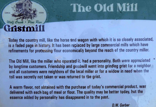
Our first stop was the Wolf Creek Grist Mill. The grist mill is no longer operational, and in fact, was moved here from somewhere else. One of the signs below will give you the information about that.
When we visited Cades Cove in the Great Smoky Mountains, we learned this about the grist mill. It was something of a gathering place in these small communities.
Here's another look at it from a different angle.
This sign was posted on the back side of the mill.
Leaning up against the foundation was this grinding wheel. These are about three feet in diameter.
And here's some information about this particular mill. Here in Babcock State Park (our present location), there is another fully operational grist mill. We're looking forward to seeing that. Of course, I will tell you all about it when I'm able.
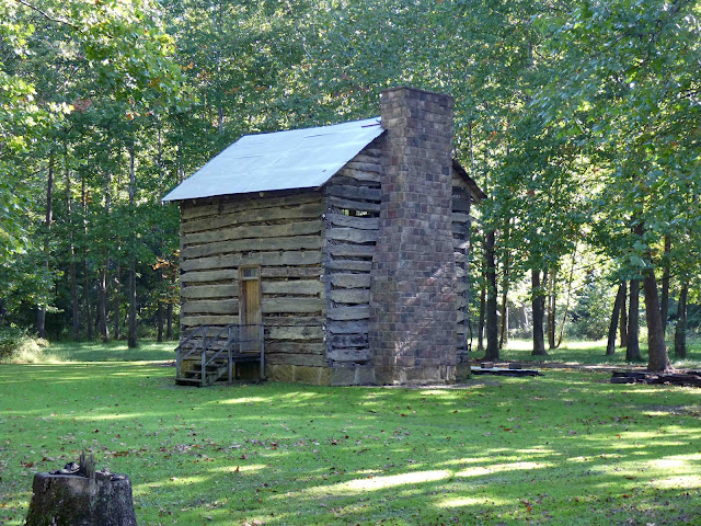
To the north of the grist mill was this log cabin. It would be open on weekends, but it was closed the day we visited.
That's okay. My camera has a "Peeping Tom" feature that allows me to take pictures through windows.
The window to the right showed more of a desk area, and those are probably informational pamphlets about the park.
Outside, we saw more grinding stones.
On the back side were some other antique implements and a sleigh.
Walking on was this wagon. I suspect the tub was used in the making of molasses.
Nearby was information about the sorghum press.
This whole area was reconstructed, but it was set up as a settler might have done it. I enjoyed reading about the hen house.
We saw barns similar to this one in Cades Cove as well. The wagon went in the middle, and loading could happen on both sides.
When these log structures are taken apart and put back together, they are numbered to make the reconstruction process easier. I'm assuming that's what the numbers on the ends of these beams were for.
The outhouse was kind of interesting. I hadn't thought about their function in the prevention of disease, but it makes sense. You can't have people doing their doo-doos just anywhere.
Does anyone know why they traditionally had the crescent moon window?
Here's an article that talks about it.
Of course, I had to look inside. Pretty primitive. Be careful of splinters.
Moving on, this was the smoke house.
It's hard to believe that meat could be preserved this way. We imagine they ate what we think of as jerky most of the time...unless the meat was fresh, of course.
Behind us was this unidentified structure. It could be in the process of being relocated to this new home.
Here's how it looks from the other side.
I poked my camera lens through the gaps in the logs and could see this inside.
There's nothing on the other side of the room. We believe they probably will still add mortar to the structure to fill in the gaps between the logs.
On the way back to the car, we passed by these blooming hostas. Hostas seem to be one of the few flowers still blooming.
We backtracked a little bit to find the visitor center, where we obtained this map. The woman there mapped out a driving route for us. We went to the areas noted along the orange route.
We started at this overlook. We've found most overlooks to be disappointing. Often, trees have grown up blocking the view of what was there originally.
And this one was like that. We might have seen the Mohican River in the gorge below if the trees hadn't completely covered it over with their canopy.
We might have taken this hike, but this series of signs discouraged us. You can go if you want...just text us when you're finished, and we'll come back for you. Maybe.
Instead, we decided to do something safer by climbing to the top of this fire tower.
Here's some information about it.
Some of you will have to wait your turn.
You might change your mind about going if you look up from here.
As we climbed the tower, we were reminded that fall is coming. As of today...it's here!!! Happy fall, my friends! You may resume drinking your pumpkin spice lattes now. For most of the day, leaves were raining down everywhere we went.
Looking out, we could see this in most every direction that wasn't blocked by the tower itself.
Looking down, you can see our truck down there.
From there, we drove to the covered bridge. As I got out of the truck I noticed these little wildflowers. Both were very tiny.
And here's the covered bridge.
We walked across the river using this boardwalk on the left side.
Looking out, the bridge spans the Clear Fork of the Mohican River.
From here, we took the Lyons Falls Trail out to the "Big" Lyons Falls. The trail started out with a boardwalk that turned to packed sand just at the far end of this image. You can also see one of the white blazes we followed along the way.
I like it when we find this on a trail. The tree roots form a natural stairway.
It wasn't hot, but it was terribly humid. By the time we reached the "Big Lyons Falls," we were sweating like pigs. And let me just say that calling these the "Big Lyons Falls," is just a big lie! I've shown you the falls with a green arrow in the image below. It was a mere trickle.
We had a choice to continue on to the "Little Lyons Falls," if we wanted to head up this big staircase. Yeah...do we look stupid? We turned around here and headed back the way we came. The more we perspired, the more annoying the flying insects became. By the time we reached our car, we were demanding free ice cream. Of course, there was no one around with ice cream to hear our demands, which simply added insult to injury.
From there, we headed back to the RV. Smitty got out for a walk and had a sample of the Meowhio grass.
He had his eyes on a couple of doves hopping nearby.
They seemed completely unconcerned about the cat walking nearby.
He was very interested in something that was growing at the edge of the woods. It might have been valerian, and kitties like it in the same way they like catnip.
And that brings me to the end of yesterday. We drove a long way today...much farther than we needed to. We didn't notice our navigation unit was taking us on a wild goose chase until fairly far down the road. We'd driven nearly 100 miles when we noticed we weren't going the right way. It made sense at first, but then we realized we'd gone too far in a southwest direction, and we wanted to be heading southeast. We were able to get back on track, but it was as if we'd only gone about 25 miles of our total route. (I hope that makes sense.) It was a long day of driving, and we're very happy to be out of the car.
We have three nights here, and we'll be exploring Babcock State Park and New River Gorge National Park. I'll have a lot to tell you when I'm able to, but I don't have enough signal here to upload pictures. We'll have to do some time traveling when I'm back in range. Until then, thank you to those of you who are following so faithfully. I appreciate your suggestions for places to visit along our way, and I appreciate your many kind comments. Thank you. I'll be back as soon as I'm able to get online.


7 comments:
View all problems as challenges. Look upon negativities that arise as opportunities to learn and to grow. Don't run from them, condemn yourself, or bury your burden in saintly silence. You have a problem? Great. More grist for the mill. Rejoice, dive in, and investigate. ~ Henepola Gunaratana
Looks like you’re having a great trip! The pretty orange wildflower is jewelweed, also called touch-me- not because the seed pods explode with the slightest touch when ripe. It is claimed that the sap from broken stems is an antidote to poison ivy, though I’ve never had occasion to test that. Have a great weekend!
Those views with all the tress will be stunning once the leaves change. Enjoy your time in the park, happy hiking!
I love my history lessons.! Glad you took the look out your walk... I'm exhausted ! Beautiful, though.
Thank you for the Smitty pictures. He is so photogenic.
Can't wait for what's next.
Be safe.
Probably the trickle of water at the Falls was due to the lack of rain and the time of year. Spring in this area of the woods is the best time to see waterfalls at the best (especially smaller falls). Interesting to hear about and "see" this place you visited.
Oh my - you climbed that tower? I'm hyperventilating just THINKING about it!! I'm not sure which is my biggest fear - heights or enclosed spaces. I'll happily join you in exploring the buildings and keep my feet on firm land thank you very much.
All that for a trickle of water, and then no free ice cream. Sheesh. You two sure have fun exploring - I bet you got your steps in!
Post a Comment