It was a short but fun daytrip over to Goblin Valley State Park. It was the first official "sight-seeing" place along our route, and the whole reason for stopping in Green River. We wanted to get an early start to avoid the heat of the day...both for us and for the kitties. It was a coolish morning, and I'm happy to say the temperature inside the camper never got above 70°F. The kitties were cool and comfy and, no doubt, took their morning naps during this excursion.
Book Cliffs begin near Helper, Utah, and are joined at Green River by a second escarpment, the
. This 2,000-foot-tall mountain wall, winds a 250-mile course along the Tavaputs and Roan plateaus, ending near Grand Junction, Colorado. It is the longest continuous escarpment in the world. Viewed in oblique light, the cliffs resemble a book lying on its side, and thus, the name. Much of this rugged region is administered as wilderness or grazing land by the federal government. We'll be driving through Grand Junction today on our way to Ouray, and so I expect the Roan Cliffs will accompany us along our route.
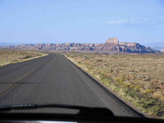
Heading west, we drove alongside the area known as the San Rafael Swell to our north. The San Rafael Swell, a part of the Colorado Plateau, is high desert country, vastly different from the Sonoran desert of the Southwest. In some sections, it consists of a sweeping landscape with towering mesas, buttes, and pinnacles rising from flat desert floors.
In other areas, it boasts rolling pasturelands populated with antelope and wild horses. The green in the image below owes its lush appearance to the San Rafael River that runs through the area. The river is little more than a stream here.
It was about a 50-mile drive to reach the state park. We were a little surprised at the steep $20 entrance fee. I'd thought the
website listed the fee at $10, but checking just now, I see it also lists the entrance fee at $20. (I'm pretty sure someone snuck in there and changed the fee amount after I checked...either that or I'm becoming senile. Which do you think is the more likely cause of this confusion?)
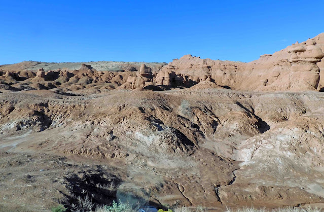
Driving on past the sign, we could see the park up ahead. As you look at these pictures, be sure to notice the bands of color in the hillsides.
Eventually, we reached the entrance where we paid our fee and were given this nifty map in return. Not bad for $20, right?
We'd read ahead in the guidebook about the hikes we could take. Two were listed that interested us, and we chose the one that was described as the "more entertaining" of the two. Goodness knows, we want to be entertained.
As we approached the outlook shelter, we found this informational sign:
We found some do's and don'ts on another sign. It sounded pretty harmless, but I want to draw your attention to the area I've underlined in blue. As you walk among the "goblins," keep this warning in mind and please behave accordingly.
The Valley of Goblins was a rather small part of the park, although in and of itself, it was fairly expansive. We could see the "valley" as we stood at the overlook.
To the left was this formation, known as the Three Sisters.
They reminded me of the formation known as the Three Gossips that can be seen in Arches National Park. Below is a picture taken on a previous trip:
To the right, some stairs were cut into the slope that allowed us to walk among the goblins.
The sun was in a terrible position for photography, and so these pictures aren't the best, but they're the best I could do.
Goblin Valley is at the southern end of the San Rafael Swell. The swell was uplifted about 40-70 million years ago. The "goblins" are known scientifically as "hoodoos," and are similar to the formations seen at Bryce Canyon National Park, although they are much shorter and less pointy.
They were formed through the gradual erosion of Entrada sandstone, which was deposited about 170 million years ago when this whole area was a tidal flat situated next to an ancient sea.
As sand washed in with the tides, the surrounding area eroded into the sea, depositing silt and clay. These components layered to form interbedded sandstone.
The unearthly shapes from the interbedded sandstone are formed through a process called "spheroidal weathering." Because the siltstone and shale layers are softer than the more resistant sandstone layers, they dissolve more quickly. As vertical cracks appear, the sandstone's sharp corners are smoothed by chemical decomposition and erosion, forming the rounded caps and curves you see here.
The red cliffs beyond the valley are going through the same process and will gradually expand the goblin landscape over the next few million years. (We won't be here to see it, sadly.)
Goblin Valley has one of the darkest night skies on earth. It is virtually free of any light pollution from populated areas.
Goblin Valley State Park is a certified Dark Sky Park and offers an unparalleled view of the Milky Way, or so we're told. Just now I went in search of an image on Creative Commons that might show this, and came up with this one:
("Shooting Star in Goblin Valley" by devinStein is licensed under CC BY 2.0)
This being the first "official" hike of the trip, our shadow selves were all about it. My shadow self was carrying a hiking pole. Mike's was...I don't know...emulating his favorite superhero.
We found these informational signs about plant life...
The only wildlife we saw was this big black stinkbug running across the parking area.
The hike was kind of meh, and so I didn't take many pictures. This was the view behind us.
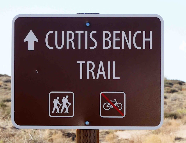
After walking a little over a half mile, we came to a fork in the trail, and decided to take the left trail toward the Valley of Goblins.
There we had a nice panoramic view of the area where we'd been earlier.
In fact, I took a panorama shot of the whole valley. Remember that you can make the image larger by clicking on it.
From there, we walked back to our truck and headed back to Green River. When we arrived, we found Sadie still napping in her cubby.
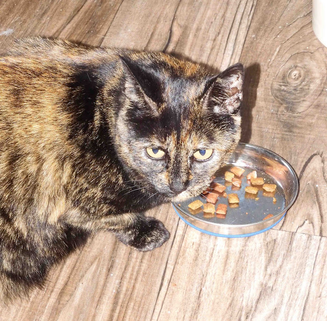
She didn't come down when her "Greet and Treats" were served up. Smitty was all about it.
Don't worry, Sadie. I'll clean yours up if you don't want them.
As it turns out, she did want them.
Smitty headed out on the catio.
We had some lunch, and then we all took naps. Smitty had the cubby this time. What a long and beautiful tummy.
And you know a visit has been successful when I can find both a refrigerator magnet...
These are the first new additions to my collections for this trip.
Okay, so that was our last day in Green River, Utah. This morning, we'll head off to Ridgeway State Park near Ouray, Colorado. We'll be unloading the camper there since we'll be staying five nights. During that time, we're going to do some ATVing which, after all, is the whole point of this journey. It's a short day of driving today, and we'll be on our way soon.
As a reminder, I don't know if I'll have internet access there, so I may or may not be blogging for the next several days. Time will tell. If I'm not able to write, rest assured we'll do some time traveling as soon as I'm back in range, and I'll tell you all about it.








11 comments:
Ocean is more ancient than the mountains and freighted with the memories and the dreams of Time. ~ H. P. Lovecraft
Looks like a fun outing for a day, even if the hike was a bit meh. Good to see the kitties too, and Smitty back to more of his old self!
Goblin Valley looks fascinating! Your info about the Book Cliffs made me think of our favorite Colorado winery, Bookcliff Vineyards. Their vineyards and tasting room are in Palisade, if you are anywhere near there on your trip. The winery and another tasting room are in Boulder, near where we live. https://bookcliffvineyards.com/tasting-touring/palisade-vineyard/
I so enjoy your travelogues with the great photos and information on the different areas and things of interest. With not being able to travel this year, I feel as if I am on holiday seeing the wonderful sights.
A friend of mine recently sold her e-bike and purchased another. She went from a big honker to a smaller one. Said it is much easier to handle and a pleasure to ride. Something to consider?
Wonderful post Barbara, thank you. You show and describe your travels so well, I feel like I'm right there with you. Looking forward to your next post. Glad the beautiful cats are well.
That goblin state park is surreal. It's eerie and spectacular at the same time. I've never heard of Certified Dark Sky. How interesting and how sad to have so few of them.
Such an interesting place to visit!
Oh, I love Ouray…..we spent time there on so many camping trips. We often camped in an area above town to get a view of the whole area, which makes one think of Switzerland. I wonder if they still allow camping there…..it filled up quickly. The trails around there are great and heavily used. I am amazed at your cats that seem to love to travel. Tell me a bit more about the catio…..what type of vehicle do your have, a trailer or a motor home? Carol in Texas
What a treat to read this post! Sadly though, it reminded me that on our trip out west I had really wanted to see the hoo doo's in Drumheller, Alberta. We looked all over the place, asked several people (who gave us conflicting directions....perhaps because they wanted to keep them a secret?) and finally, due to time constraints had to leave without catching sight of them.
What a cool park, the name is even fun. Very fun photos, even in the stark lighting.
Post a Comment