Driving out of town, we noticed the old Caliente railroad building, which is now used for city offices, including the public library.
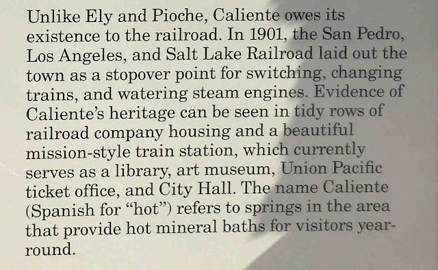
You can read more about the town of Caliente on its Wikipedia page right here. When we reached the visitor center at Cathedral Gorge, I took a picture of a sign explaining the origin of the towns in the valley, and I'll cut and paste sections as they become relevant. Here is the section that pertained to Caliente.
It was 16 miles to the first park we visited. Cathedral Gorge State Park is located close to Panaca, Nevada. Here is a little information about Panaca.
I'll tell you a little more about Pioche in a minute, but first, let's take a look at Cathedral Gorge, shall we?
There haven't been many barns in our travels lately, but this one was visible from the visitor center parking lot. It actually looks as if it might be a private residence...for humans.
We paid our fees at the visitor center, and then headed into the park.
The paved road leading up to the gorge is short, and turns to dirt where the scenic portion begins. From there, we parked and got out to have a look around.
Oh my gosh. What an incredible place.
We were able to walk into the narrow slot canyons. Looking up, this is what we saw.
Back outside, Mike was trying to get his drone to fly. He was having trouble after downloading some new software the morning of our visit, and so we spent some time puzzling through that. He wasn't able to get it going until later in the day, and so we might come back again. This was a perfect place to record some video.
The pink in the lower portion of the image below is caused by lens flare.
There were slot canyons all along the face of the wall, and we walked back in at several places. The walls towered at least 100 feet overhead in places.
I've been in slot canyons before, but none so narrow as these.
In some places, I couldn't put one foot ahead of the other.
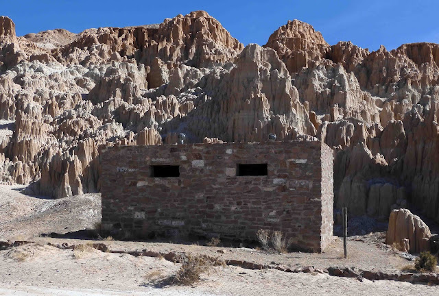
Driving on, we came to a complex of structures built by the Civilian Conservation Corps. We love stumbling across these CCC projects. Here's the first one we encountered.
There was a very large and faded sign nearby that explained all of the structures. I'll cut and paste the relevant portions.
To the front it looked like this. The door is barred and locked.
Still, I stuck my arms through the openings and took a blind shot upwards. This is what the camera could see:
Walking on, there was a picnic area and the original pit toilet.
This is the original structure. A more modern restroom is located nearby...still a pit toilet. If you want to know my feelings about it, the words "pit toilet" and "modern" do not belong in the same sentence.
Here's the picnic area.
These towers were to the right of the shelter.
Here too, we walked back into the slot canyons a short distance.
Here's a panorama of the area.
We decided to take the 1.5 mile hike back through the gorge and to the Miller Point Overlook.
Here is some information about the gazebo at the overlook. I'll show you pictures in just a minute. For now, here is some information about it.
The trail looked easy and it was well-marked.
About halfway along, we encountered these stairs. There were the first of many we would climb to get to the overlook. I hope you brought plenty of water and some comfortable shoes.
We could see the gazebo at the top of the wall.
There were more stairs to climb.
Looking ahead, we could see this:
But we're not finished yet. More stairs to climb.
Let's stop here and rest for a second. Huff, puff, huff, puff. Looking back, this is what we saw. You can see the trail where we walked in.
Oh, but we're not finished yet.
Okay...last bit of stairs. Come on, you can do it.
At the top, there was a sign, facing the opposite direction. Now they tell us.
Looking back, this is what we saw:
In the other direction...what the...? There was a parking lot there. As it turns out, we could have driven to the overlook on the state highway and parked here to see it. Oh well...just be glad you got your exercise today.
On the white structure that appears as a tombstone was this plaque.
From there, we went back the way we came. As we approached the end of the trail, I took this shot to my right, looking across the valley.
From there, we got in the truck and drove to the next spot along our route, Echo Canyon State Park.
There wasn't a lot to see here. There is an earthen dam. You can see it in the middle of the image below.
On the other side, a reservoir. Looking to the right, we saw this:
To our left, we saw this:
Looking all the way across, we saw this large bird. It doesn't appear to be a crow. And, yes, this is a terrible image. I was zoomed in with digital zoom, just trying to see what it was. Possibly a hawk or a juvenile eagle. It is not a crow.
Later, I saw it soaring overhead.
There was a boat launch, but the water level was down. We drove down the boat ramp to the water's edge. There, we sat on the trailgate and ate our Clif bars looking out across the water.
Mike finally got his drone to fly here. It needed some "calibration." Yeah...don't ask me. Anyway...coincidentally, his shadow self got its shadow drone flying at the very same time!
From there, it was just a few miles down the road to the third park we visited, Spring Valley State Park.
We drove farther back into a canyon where we encountered another dam and another reservoir. No ice skating, please.
And wow...what a difference a few thousand feet of elevation makes. Here, the water was frozen. You can see the dam in the middle of the picture.
We saw this at both reservoirs. Life jackets for lending. What a great idea!
There was a dock here, and some people were out fishing.
Looking back, there was another boat launch.
And that was pretty much the end of our day. We had about a 30-mile drive back to the RV. Along the way, we marveled at these wide open spaces. There are several small communities back here, but lots of open country. We noticed some ranching and a few junkyards, but not much else.
Below, I've cut and pasted a little more information from the signs.
The thing I was most interested in was this abandoned mining operation.
This is what Wikipedia has to say about it:
An aerial tramway carried buckets of ore from the mines to the Godbe Mill. The tramway ran during the 1920s and 1930s and was used for the transportation of silver and nickel ore. The abandoned tramway used cables which still stretch over parts of the town, with some original ore buckets intact.
And here they are:
Back at the RV, we got Mr. Smitty out for a walk. With incredibly bad timing, the park owner drove up in an ATV just as he was getting ready for his roll in the dirt.
His shadow self was willing, but Smitty needed more time to work up his courage for being out in a strange place. We'll give it another try later today.
Here's Sadie's proof of life photo. There have been no ransom demands yet.
I'd worked on my inchy for the day in dribs and drabs. Finally, after dinner it was finished.
Today our plan is to head down to Kershaw-Ryan State Park and Elgin Schoolhouse State Historic Park. There's one other park nearby...Beaver Dam State Park. I believe we'll have time to see all three today.


14 comments:
I love gorges! Really nice pics and explanations of all the interesting bits. Hard to believe there is ice on that water.
I just read yesterday's post and please tell Mike to keep the drone videos coming. The clarity is amazing. It's like Google Earth only much better.
Magnificent. But, oh dear, doesn't using the trail "at your own risk" mean that you actually flirted with one-of-the-ways-you-could-die today? Nervy. Next time, consider following Smitty's more conservative example.
Love all the interesting tid bits and photos. I would not be able to do all those stairs.
I could almost hear your knee begging for mercy on that climb, not to mention the descent! That would have done me in. You got some fabulous photos of that first park.
Wow. What a great place.
What a super day out, I am sure that those steps would have me worn out if I didn't happen to be reading this as I lie in bed trying to decide what to do today. Nasty weather prohibits going out....except with you et al of course!
Thanks for sharing....think I'll lie here for a bit and rest ...
Wait - there were no ways to die while going through the slot canyons? I probably would've gotten stuck in that narrow spot. Yikes. Nervy, having a parking lot at the lookout but not telling you at the beginning of the hike. At any rate, it looks like a fun day of exploring!
There is so much history in those western states and so interesting. I'm certain that neither Terry or I would be able to walk too far in your steps. Thanks for the visual tour.
xx, Carol
What a sweet little slot canyon. Just large enough to enjoy but not get lost. My only experience with slot canyons was at Arches NP. Hearing the tales of bandits etc hiding out and others who got lost gave me bad dreams of being lost in a maze. These canyons seem more friendly. Loved your hike. I’m sure your fitbit went wild seeing all those flights of stairs you did. You may have had an epic day to remember on the app. Thanks for the tour.
The slot canyons are awesome!! I have never seen anything like that in "person". I happen to think they are beautiful and thanks for all the pictures..I think i would be looking for snakes in those places, do you ever come across any??
Such great photos! Love the shoe shot in the slot canyon. I believe the bird is a golden eagle. They have a wider wing span than the bald eagle. Enjoying your trip immensely.
Whew! Glad I did have my hiking shoes on, what really wore me out! Time to down a bottle of water, non alkaline, thanks. Glad to see the kitties, aka Proof of Life! All is good!
Looks like quite a climb, but those views, just WOW!
Amazing things to look at on today's hikes! Thanks for taking us along...I'm glad I was sitting down for all those stairs!
Love the drone videos - tell Mike thanks for those :)
Post a Comment