

We passed by a very large solar array, possibly the largest we've ever seen. You can see it as a black band near the middle of the image below.

And when you travel with an engineer, it's important to know all the specifications about something like this. So we consulted our friend, The Google, and found the "project summary," right here. The summary was from 2014, but it lists the project as "completed" now.
Wikipedia tells us that solar power in Nevada has grown due to a Renewable Portfolio Standard which required 20% renewable energy by 2015, and 5% from solar power. The state has abundant open land areas and some of the best solar potential in the country. You can read more about Nevada's commitment to solar power on its Wikipedia page right here. We often come across renewable energy projects in our travels, and seeing something like this gives us hope for the future.
Moving on, the road was good and the route was fairly straight for much of the day.

I liked the bands of color in this hillside.

Moving north, we passed by the Pahranagat National Wildlife Refuge. There was both a lower and upper lake, with the upper lake being the larger of the two. Sorry I wasn't able to get a better picture. The lake was obscured by cottonwood trees.

On a different day we might have stopped for lunch here, but we soldiered on since we expected to reach the RV park just after 1:00 p.m.
As we moved north, we practically had the road to ourselves.

We passed through piles of boulders that reminded us of Joshua Tree National Park.

Also, wide open spaces, with one flying crow.

Toward the end of the day, we passed through a section of Joshua trees.

Crossing over Oak Spring Summit, we found snow on the north-facing hillsides. Elevation here was 6,237 feet, the highest of our route.

There, we encountered Pinyon pines.

Crossing over the top of that hill, we started descending into the valley. We could see snow-capped peaks off in the distance.

There seemed no end to the variability of the terrain yesterday.

Turning around that bend, the little town of Caliente, Nevada, came into view.

There was a bit of shuffling around when we arrived at the RV park. Although I'd spoken to the gentleman a few days earlier, there was no water at our reserved 50 amp spot. They'd turned off the water to that section of the park because of the cold weather. It was fairly warm yesterday afternoon, and didn't even get below freezing overnight. So, there was a question of whether a 30 amp spot would be acceptable, and we declined. With 30 amps, we can't run our heat pump. Also, we have to be careful running any appliance that generates heat to avoid blowing a fuse. And so, no, a deal's a deal, and 30 amps was not acceptable. He was courteous, and turned on the water. After we arrived, another trailer came in and parked a few spaces away from us, so there was more than one camper using 50 amps last night.
Here's a little video Mike took of the surrounding area here at the RV park. If you look closely at the end of the video, you'll see the top of our RV where Mike installed the solar panels. They've been working great in these sunny areas. If you can't see the video, then click right here.
Also, I've mentioned that RV parks tend to be in close proximity to (a) interstate freeways, and/or (b) railroad tracks. And, amazingly, we haven't encountered any railroad tracks so far on this trip...until now. After we'd been here about an hour, we felt the tell-tale rumbling, and sure enough...a train runs about 200 yards away. I took the picture below through our dining room window.
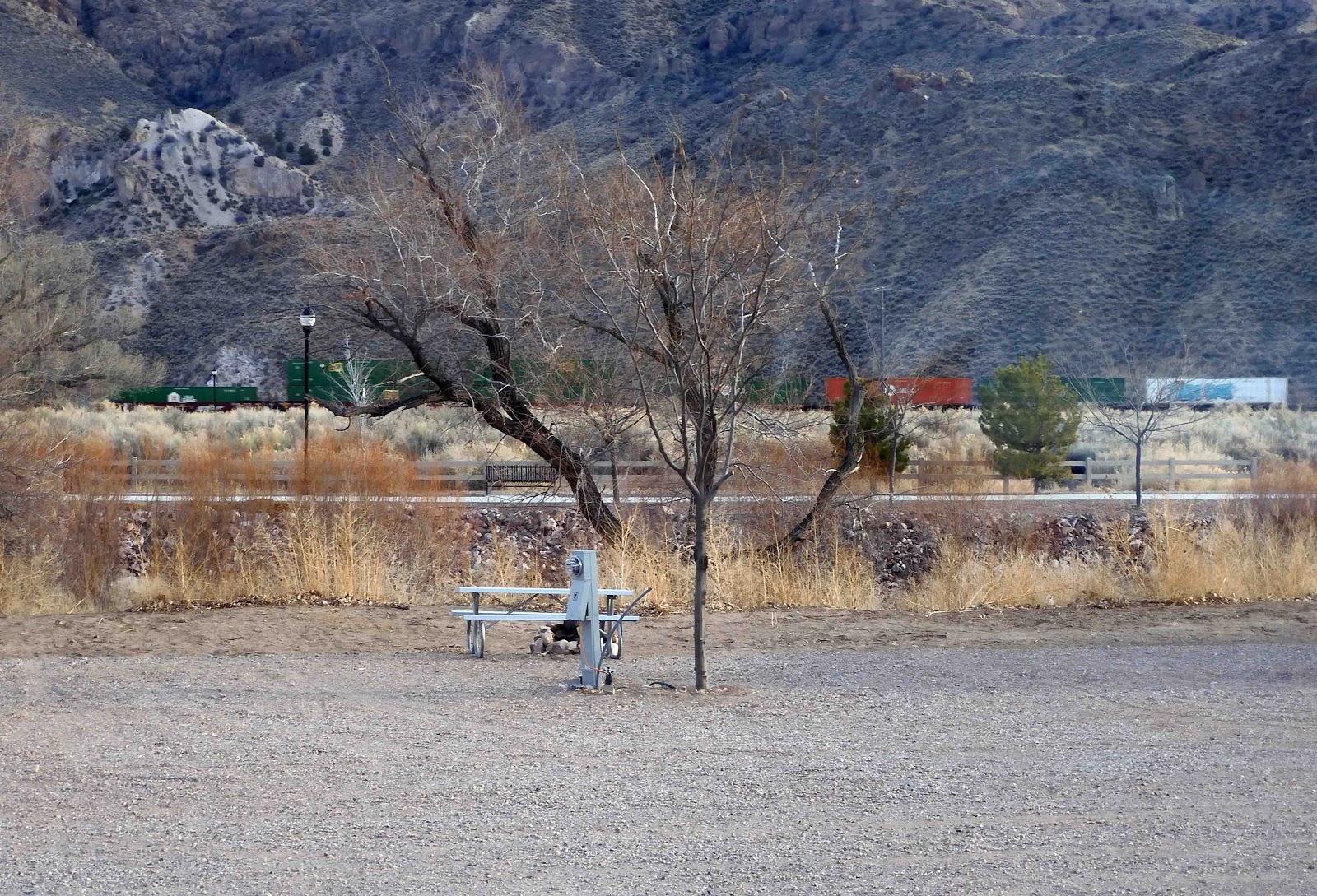
Fortunately, there are no intersections nearby, and so it doesn't blow its horn, as they usually do. It just rolls on through approximately every two hours. We weren't bothered by it last night, although I did hear it go through a couple of times.
After we arrived yesterday, I stitched the day's inchy. This one is all backstitch, double lazy daisies, and French knots.

After that, we messed around with the drone videos again. Mike is still learning to use his drone, and so the videos he's taken so far aren't particularly interesting. Nevertheless, today I have another one to share with you. This one is from our current trip when we were boondocking near the Trona Pinnacles. If you missed that post, you can find it right here. So here's the video. If you can't see it, then click right here, and enjoy...or don't. Enjoyment is always optional.
We are in close proximity to a half dozen or so Nevada State Parks. Our real reason for coming here was to see Cathedral Gorge State Park, and so we'll do that today. It is about a half hour's drive from where we are. I've given you a link to its web page, and I would encourage you to click on it and see the video of the park. It is stunningly beautiful. I can't wait to see it with my own eyes.
At a minimum, we'll also see Kershaw-Ryan State Park and the Elgin Schoolhouse State Historic Site. There are a few others, but we'll only see them if we have time. If not...it'll be a good excuse to come back some time.
2 comments:
Lots of great places to visit there. I had to smile at the pic of the crow flying. When we are in the car and Terry sees a bird flying by he asks me what bird it is. I usually answer it was a crow. He tells me that I think every bird flying by is a crow. It's become our inside joke.
xx, Carol
Fun to see you two waving. I'm enjoying the drone videos! I'm looking forward to seeing the Gorge photos too; sounds like a lovely place! Your inchies are really fun, and perfect for little sewing moments!
Post a Comment