Good morning, my friends. We're moving closer to the Canada/USA border today. Tomorrow's post will be my last from Canada. But let's not get ahead of ourselves. Let's talk about yesterday's drive, shall we? I started seeing barns and rustic structures right away after leaving Houston.
I've abandoned the Milepost for the remainder of the trip. I was looking up these little communities on Wikipedia as we passed through. We passed through a series of small communities associated with the many lakes we saw along the way. Here's another grouping of rustic buildings. I like a fence that looks like that.
The first community of any size we passed through was Burns Lake.
Wikipedia tells us that Burns Lake is known for its rich First Nations heritage, and for its network of mountain biking trails, which have received acclaim by becoming Canada's first IMBA Ride Center. In winter, cross country skiing trails and snowmobile wilderness trails are created. Burns Lake is located in the midst of a large network of lakes called the Lakes District, with fishing and hunting year round, and water activities in the summer months.
I took a few pictures as we passed through on its winding main street. This next one turned out to be a sporting goods store, but the clock tower caught my eye.
Also, this little chapel. I regret not getting the top of the steeple there.
The town serves as a hub for the local logging, saw-milling, mining and tourist industries. It also serves as the main commercial center for the surrounding area including François Lake, Colleymount, Grassy Plains, Rose Lake, Topley, and Granisle. Here's a shot of Burns Lake. We paralleled the railroad (and the train) for a good part of our day.
Burns Lake acquired its name after Michael Byrnes, who was an explorer for the Collins Overland Telegraph scheme. Byrnes passed Burns lake in about 1866 while surveying a route from Fort Fraser to Hagwilget. Recent research indicates that Byrnes was also a miner during the Cariboo Gold Rush and had staked a claim on William's Creek in 1861. On the 1866 trail map of the area, the name "Byrnes" Lake appears. After 1876, however, the maps indicate it as Burns Lake.
Bob Gerow, one of the main founders of Burns Lake, entered into partnership with Jack Seely and Howard Laidlaw to create Burns Lake Trading Company. Together, they built a store/hotel and a sawmill on Gerow Island, which would become the hub of trade for the surrounding area. The village was incorporated on December 6, 1923.
We also passed through the communities of Fraser Lake and Fort Fraser. That's Fraser Lake below.
Fraser Lake's population is primarily employed by either the forest industry. Fraser Lake Sawmills, or various logging contractors. Also, the Endako Mines, a large molybdenum mine, was a former large employer. And I have to say here that the only other time in my whole life I've heard molybdenum mentioned was in my high school chemistry class. Molybdenum: Mb. The only thing I remember from high school chemistry are the mostly two-letter abbreviations for the periodic table of elements. And just to show off a little...Tungsten: W. Antimony: Sb. It might be the most useless thing I have committed to memory, but there you go. I can't remember why I came into a room, but I can remember that Iron is Fe. Copper is Cu. Shall I go on?
Getting back to Fraser Lake, the pioneer roots of the area's history date back to the fur trade, with the establishment in 1806 of a fur-trading post by Simon Fraser, at Fort Fraser near the east end of Fraser Lake. The modern day town was established in 1914, during the construction of the Grand Trunk Pacific Railway, and was incorporated as a village in 1966.
Regarding Fort Fraser, it was originally established in 1806 as a North West Company fur trading post by the same Simon Fraser. It is one of present-day British Columbia's oldest permanent European-founded settlements. The area around the community is also recorded as the site of the first land in British Columbia cultivated by non-First Nations people. The original site of the fort is 4 km (2 mi) to the west, in Beaumont Provincial Park. We didn't turn off to see it. In 1911, the fort was relocated to nearby Nadleh Village, and later closed in 1915. Today, Fort Fraser is an active community sustained by both forestry and tourism.
Eventually, we crossed over the Nechako River.
Here's another barn, accompanied by a caboose. I suspect that has something to do with the fact that Fort Fraser is located at the site of the last spike of the Grand Trunk Pacific Railway, driven on April 7, 1914.
There's a productive harvest.
Eventually, we passed through the town of Vanderhoof, which, as the sign notes, is at the geographical center of British Columbia (or "centre" if you're of that persuasion).
Wikipedia tells us that Vanderhoof is named after Herbert Vanderhoof of Chicago, one of its founders. He was an employee of the Grand Trunk Pacific Development Company, a subsidiary of Grand Trunk Pacific Railway. The municipality's population rapidly expanded until World War II, when many of the town's men left to fight overseas. After the war, an increase in lumber prices and the construction of the
Kenney Dam lead to increases in population again. Today, Vanderhoof is a service center in the eastern Bulkley-Nechako region of surrounding communities, and the second-largest municipality in the district. It has its own lake.
Eventually, we passed through Prince George. It was here that we turned south on the last highway we'll travel before crossing the border. We're now on British Columbia Hwy 97.
You might remember we passed through Prince George at the beginning of our trip. You can
read my post about Prince George right here. We're in a different part of the city this time around. Look over yonder in the image below. It was some distance away...sorry for the blur. We're just about to cross over that bridge.
Here we go. This is the Fraser River.
We were nearing our final destination by then. Here's a structure that's seen better days.
And I really liked this barn.
I love these First Nations symbols. I'd like to turn one of these into a quilt someday.
We passed by more rustic structures...
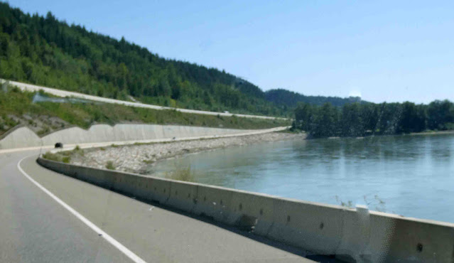
This was an interesting highway configuration. The lanes we were traveling were shored up with riprap at the lakeshore. The oncoming lane was elevated above us.
And we passed by a few more barns before reaching our final destination.
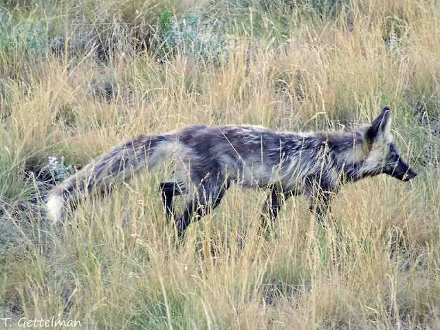
In wildlife sightings, I have just one to tell you about. As we drove out of Houston, another red fox crossed the road in front of us. He looked different from the ones we've seen previously. Of course, he was too quick for a picture. I found this one in the public domain.
(Image credit: red fox, (Vulpes vulpes) cross fox coat variation, North of Boise, ID" by Tatiana Gettelman is licensed under CC BY-NC-SA 2.0.)
Here's what AI tells me about this fox. Red foxes can have darker fur variations, including cross foxes and silver foxes (also known as melanistic red foxes). Cross foxes have a dark cross pattern on their back and shoulders, while silver foxes are predominantly black with white-tipped hairs. These variations are due to different pigmentations in their fur, specifically melanin, which can result in a range of colors beyond the typical reddish-brown.
I've realized that it's more difficult to get photos of these carnivorous animals. They don't stand still by the side of the road grazing on the grass as moose, elk, deer, caribou, wild horses, bison, and the like are prone to do. The carnivores are on a mission...usually hunting for their next meal...and so they don't stand still for pictures.
As we reached our final destination of Quesnel yesterday, we noticed some signs indicating that several vendors along the roadside were serving up "the best donairs on the planet." And if you're like me, you've never heard of a "donair." So I inquired of The Google, who tells me that a donair is a type of sandwich, popular in Canada, featuring shaved, spiced beef served in pita bread with toppings like onions, tomatoes, and a sweet, creamy sauce. It's a variation of the Turkish döner kebab and is closely related to the Greek gyro. The key components are the seasoned donair meat, the sweet donair sauce, and the pita bread, often with added onions and tomatoes.
Okay...well, this I gotta try. When in Rome, right? So I looked to see if any local restaurants served donairs, and three popped up nearby. That was last night's dinner, and it was very tasty. Mike had one with beef. Mine was chicken. It's basically a sort of open-faced wrap.
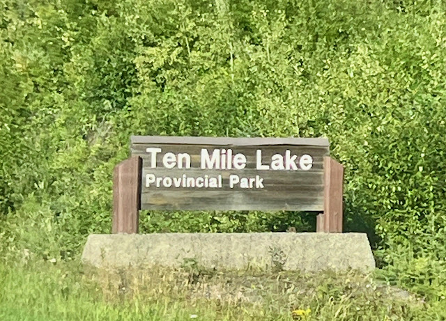
So our campground is adjacent to this provincial park.
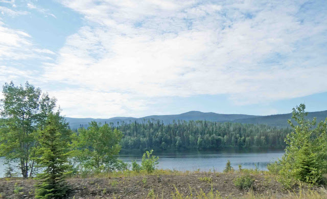
We passed by the lake heading into the campground. On our way back from the restaurant, we stopped to have a look. There is a boat launch and a swim platform in the water. Looking left, it looks like this:
Looking right, it looks like this. It's a big lake, and with a name like "Ten Mile Lake," I have an idea it spans ten miles. And just as I wrote those words, I wondered why it isn't something more on the order of 16.0934 Kilometer Lake. Huh? What's up with that, Canada?
Also, we passed by this very large nest perched on a utility tower. We saw another one as we drove to the restaurant. These are big nests for big birds...eagles, maybe. Earlier, we could see a bird in this one, but it was in silhouette against the bright sky. We couldn't tell its colors.
So, we're here in Quesnel and heading out soon. We passed through Quesnel on our way north. It was mentioned in the post I linked to earlier. And, hooray!! I'm very happy to announce that the air-conditioning in the truck started working just before we arrived at our spot for the night. It started working as mysteriously as it quit working. I can't explain this very well, but apparently there's some kind of "clutch" that has to engage to make the thing work. We're starting to think a rock or something might have gotten kicked up into the works, preventing it from working properly. Whatever the case, fingers crossed it will continue to work until we get home.
Our drive today will be just a little shorter than yesterday. We'll end up in Ashcroft, B.C., for the night, and that will be our last stop in Canada before we cross the border into Washington state.











9 comments:
Possibly that was a stork nest that you saw atop the electrical poles.
Lovely day with you. Once again, gorgeous scenery. I'm not familiar with donairs, but will try to keep an eye out for them.
Mmmm, the donair does look good! Sooo glad your AC started back again! What a blessing 😻!
It looks like an osprey nest to me but I don’t know if they would be in the region where you saw the nest.
I have been seeing reports this morning of an earthquake in Russia that has prompted tsunami warnings for Alaska, British Columbia, Washington state and Oregon. I hope you are well out of harm’s way…
As you make your way home, I just want to thank you for taking us along…you always provide such great information along the way and while I always love seeing all the pictures you share, the pictures from this trip have been better than ever. Some of the mountains shots have been truly breathtaking!!
It really is a beautiful world we live in!
So glad the air conditioning is working….safe travels for the remaining miles of your journey!!
Sandra B
scb23229@yahoo.com
My guess on that nest would be osprey. Whoever is living there, it's a big nest!
The nest is likely an Ospry nest. They are plentiful on tele/electric poles near bodies of water.
That nest could have been an osprey because I know they like to build on top of things like that and out in the open too.
I laughed when I read about the 16.0934 Kilometer Lake - obviously it was named before Canada decided (wrongly IMHO) to adopt the metric system.
Those lakes are so blue! Here is Oklahoma they all look muddy brown/orange. So glad the air conditioning started working. Fingers crossed it holds out till you get home.
Beautiful and more beautiful post today. Traveled well today.
*snort*, giggle, me too...don't know why I entered the room...you are way ahead of me. Never took chemistry. Still waiting for the "what are you gonna to be when you grow up" to kick in. sigh. Don't think it's gonna happen. I'm 72.
Glad about the AC. Whew.
Sadie you just keep being your cute self.
Post a Comment