Good morning, my friends. When I left you yesterday I wasn't sure where we'd be this morning. The road between Chitina and Tok was rumored to be very rough. From where we started, we had 200 miles to drive. Depending on road conditions, that can be a short day or a very, very long day. The road was bad, but only in an annoying way. We got tired of bouncing over bumps and frost heaves, and our speed was much slower than a usual driving day. Nevertheless, by the time we reached the halfway point, it was clear we could make it all the way.
And so, my friends, we find ourselves back in Tok this morning. It was our first stop when we crossed the border into Alaska, and it will be our last stop in Alaska as we head for home. We have two days here. Already I've done laundry. We need to do some grocery shopping, keeping in mind the border crossing and trying to avoid getting a bunch of stuff that could get confiscated. And so you might say we're gathering our supplies and our wits for the long journey home. I'll tell you about yesterday's drive in tomorrow's post, and I'll tell you about today's wanderings, routine though they may be.
This morning I want to tell you about our trip to Kennecott Mines National Historic Landmark. If you click on that link, you'll find an excellent resource for understanding the layout and history of this mining town. There is a video and a pdf map and brochure that will explain it all. I took about a hundred pictures here, and I'm not at all sure I have them in the right order, and so I encourage you to check the link as well. For now...here's what we saw.
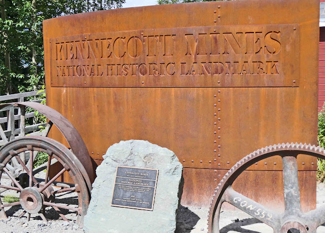
We got off the shuttle here at this sign.
This is what the plaque says:
I took a picture of the map posted there, but it wasn't possible to fit the whole thing within my frame and still have it be legible. Again, I encourage you to lick on the link above to see a better map. The "You Are Here" portion was just outside the frame and to the left of the image below.
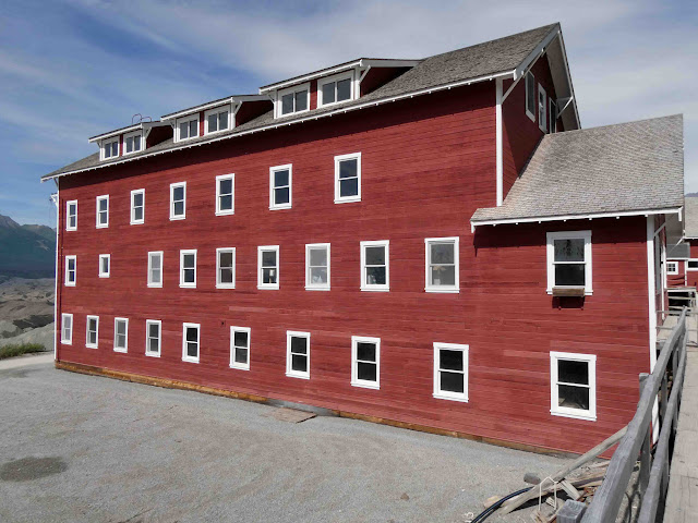
We came first to the bunkhouse. These structures were huge.
Here's how it looks from the front.
Inside one of the exhibit halls, I found this sign.
This was a photograph of how the bunkhouse looked inside.
Moving on, we came to this structure that served as the post office and general store. This was a company town, and so everything was supplied to the workers and their families by the Kennecott company. The town also included a recreation hall, a hospital, and school.
Here's the front of the building. (That man really wanted me to take his picture.)
Inside the door to the post office, it looked like this. The postman would have met you at the window just at the left side of the frame.
The right side and back portion of the building was a commissary, general store, and storehouse.
Walking on...some of the buildings have deteriorated beyond repair, but a concerted effort is going into restoring as many of the buildings as possible. (One wonders how DOGE cuts will affect this effort.)
And this was the structure I really wanted to see. This is the mill. I don't have a great understanding of this process. Again...you can click on the link I provided above for a more complete explanation. Miners underground mined for copper ore. It was brought to this mill where the large rocks were crushed and then sent down a chute to a building on the opposite side of the street. This building is still being restored, and there were warning signs about asbestos.
Standing on the far side of this bridge, we could see where rail lines ran in both directions.
Rail cars could move under this structure for loading with minerals to be taken to market.
The mill was huge. Standing in front of it and looking up, this is the best I could do to fit it within the frame of my photograph.
Here's a little information about the process.
On the opposite side of the street was the power plant.
Here's some information about that.
Inside, looking down and to the left, it looked like this. That big gray box near the middle is a big diesel generator.
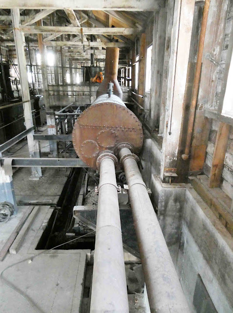
These are boilers that ran on oil.
Here's a big oil tank.
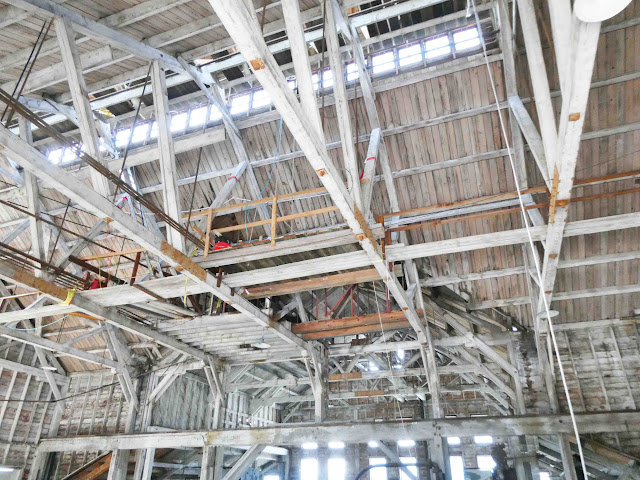
Looking overhead, it looked like this:
Moving on, we came to this cottage, open for viewing.
Inside, this would have been the living room.
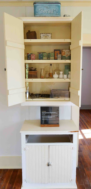
To my left was this pantry.
Here's a little information about the things inside. (Sorry about the reflections.)
That bottle in the middle was a catsup bottle.
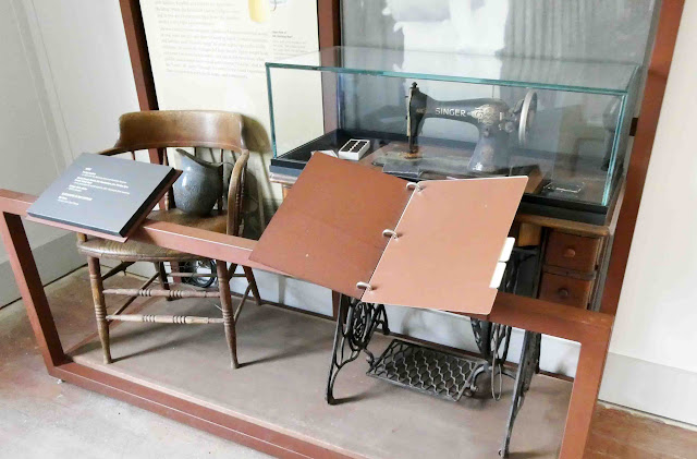
In a separate room was this treadle sewing machine.
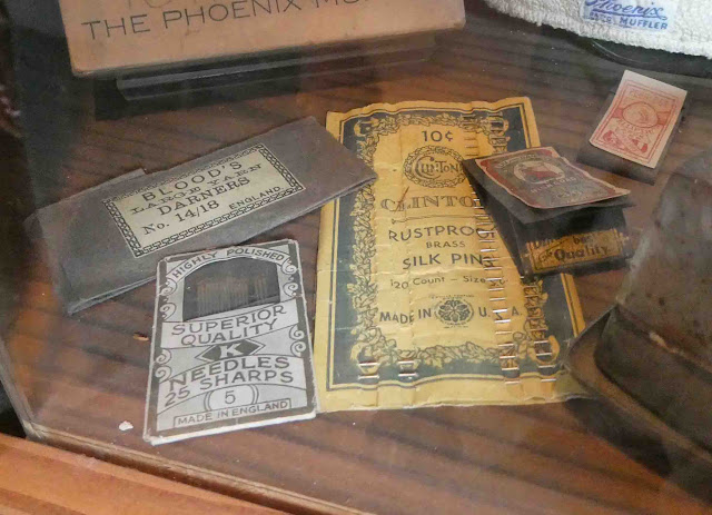
Here's some vintage thread inside the display case.
This would have been the bedroom. They need to make up this bed and add a quilt! Heck, I'll even give them a quilt if they're looking for one!
This was a small nook area. Presumably, there would have been a small table here for eating meals.
This is what some folks might call a "mud room."
Returning the way we came, we could look out and see many square miles of mine tailings. Mike observed that this stuff is probably riddled with heavy metals and highly toxic. It makes us think the river running through McCarthy is probably polluted as well since it is fed from snowmelt.
These are some signs I thought were interesting as we walked through a few of the exhibit halls.
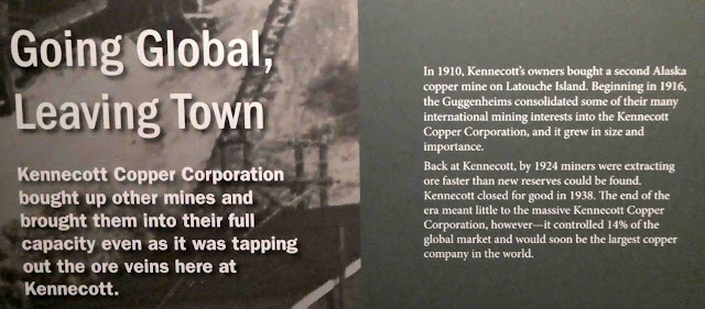
This talks about when the company left town and closed the mill.
And this talks about efforts to turn the whole town into a national landmark.
A little about the efforts to stabilize the structures.
Here's some information about what it would have been like to be a miner here.
Some had families. If you'd been somebody's wife, you might have lived like this:
This might have been your sewing machine. It probably needs a little lubrication.
And you might have used these needles for your hand work.
If you'd been a child here, this would have been your life.
And these might have been your toys.
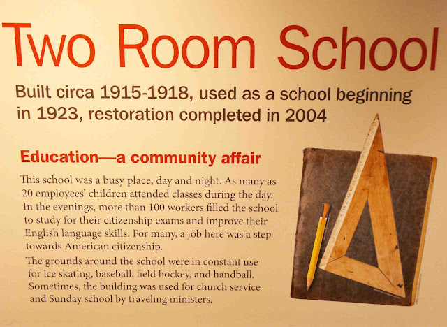
You would have gone to school right here.
And these are some supplies you might have used. I regret the title of that book didn't show up in my picture. It was some kind of a reader, but not Dick and Jane.
And if you'd been a teacher, this is what your life might have been like.
Walking back to where we started, I captured what the town looks like as you approach.
We walked down a slope to a lower level. There, we found artifacts of some of the machinery.
Also, in those days, folks thought of our planet as an inexhaustible resource, and they just dumped their garbage wherever there was space. We've seen an area like this in the ghost town of
Rhyolite, near Death Valley. All that dark stuff at the bottom of the image is rusted out garbage.
When we reached the shuttle drop-off and pick-up spot, there was a shuttle there. Since we'd already finessed our way out there without having to pay, we weren't sure what it would take for us to get back. I spoke to a nice young man who said he'd take us for tips only. Sure thing. With free parking and avoiding paying any fees to the shuttle, we ended up spending $6 for our day that (by rights) should have cost more on the order of $27 (plus gas). Definitely a bargain.
Today we'll be picking up enough groceries to get us down the road to Whitehorse, Yukon Territory, Canada. Tomorrow we'll cross the border back into Canada. We'll be back-tracking over roads we've already traveled (very bad roads). When we reach Whitehorse, we'll head south along what's known as the
Cassiar Highway. We're hoping for good road as we make our way south through British Columbia.
In tomorrow's post, I'll tell you more about our drive between Chitina and Tok, and then we'll begin the trek home. Rest up, my friends. We still have many miles to go.

















5 comments:
That bedroom definitely needs a little attention - definitely a quilt!
What a fun last adventure in Alaska. It's definitely been a memorable trip, the scenery is just stunning. Fingers crossed the roads are drivable and you can manage without the air conditioning.
What you saw on top of the glacier was not actual mining tailings, it was basically dirt, ground up rocks, etc, that the glacier creates as it moves. You've seen the dark dirty trails in glaciers? Well, sometimes it's on top. It's also on top of a lot of the Matanuska glacier, and there are even trees that grow from it!
Amazing time in our history. I don't think I have ever been to an historic mine that large before. Looks well designed an implemented, to give everyone the best living they could for the situation.
There must have been a sale on red paint! Lots of interesting things to read about and see - thank you.
Post a Comment