Good morning, my friends. We're 216 miles closer to home this morning. We still have three days of driving ahead of us, and a long way to go. If I had to choose one word to describe yesterday's drive, it would be "monotonous." So, first, I'll tell you about the most exciting part of the day, and then we'll end with the monotony. How does that sound? I know...monotony. Everybody's favorite.
As we sat eating our Sunday morning pancakes, four wild turkeys strolled by.
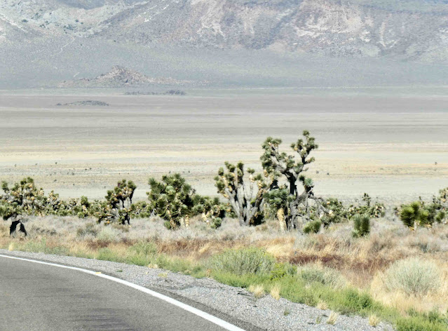
In the southern and western Mojave Desert, Western Joshua trees (Yucca brevifolia brevifolia) grow tall and straight, with long leaves. In the eastern portion of the Mojave Desert, Eastern Joshua trees (Yucca brevifolia jaegeriana) grow shorter with more branches (sometimes shrub-like), and the leaves are shorter. There are many other differences between the two subspecies: including flower shape, fruit shape, and pollinators. Their common name came from the Mormon settlers who likened the tree to the biblical prophet Joshua with his arms uplifted towards the sky in prayer. And get this: Joshua trees can live to 300 years.
Moving on, we passed piles of rocks like these on both sides of the road. These are the sorts of rocks you'll see in southern California. I've written about these rocks before when we've been traveling in the area. If you want to know more about them, you can see more at this blog post from last spring.
There was almost nothing anywhere along our route today, but we passed through the tiny town of Rachel, Nevada. As the closest settlement to Nellis Air Force Range and Area 51, Rachel enjoys a modest celebrity status, particularly among aviation enthusiasts and UFO hunters.
Oh, and here's something else: In 2006, KFC created a giant company logo on the ground at the north edge of Rachel and claimed it to be the first logo visible from space. Constructed in early November, it took six days to assemble the 65,000 colored tiles on 87,500 square feet of flat desert terrain. The logo also had a hidden message on the tie area of the logo that featured an impostor colonel holding a sign over his head, reading "Finger Lickin' Good". The logo was removed in mid-2007. Bummer. I might have wanted to see that.
Okay, so let's talk a little about the monotony of driving in Nevada. Pretty much all of Nevada can be contained in what is referred to by geologists and hydrologists as a "Hydrographic Great Basin." Here is a quote from the website of Great Basin National Park.
The Hydrographic Great Basin is a 200,000 square mile area that drains internally. All precipitation in the region evaporates, sinks underground or flows into lakes (mostly saline). Creeks, streams, or rivers find no outlet to either the Gulf of Mexico or the Pacific Ocean. The region is bounded by the Wasatch Mountains to the east [near Salt Lake City], the Sierra Nevada to the west, and the Snake River Plain to the north. The south rim is less distinct. The Great Basin includes most of Nevada, half of Utah, and sections of Idaho, Wyoming, Oregon, and California.
Here is an accompanying diagram:
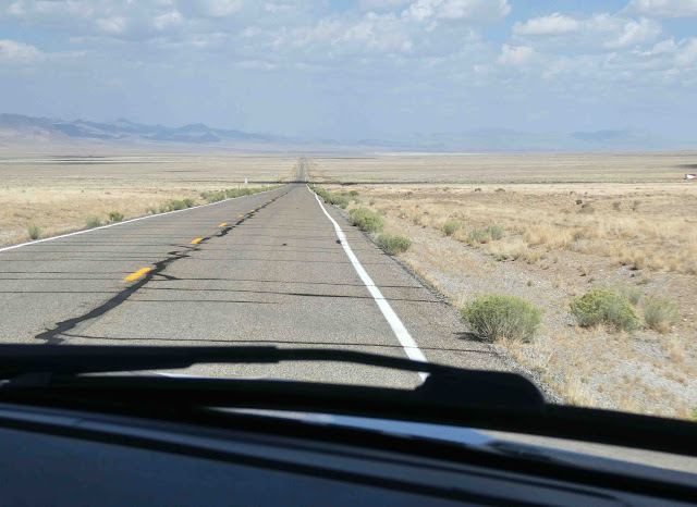
To us it meant long straight roads over a ridgetop...

We were nearing our final destination by then. Along the way, we passed by the Tonopah Test Range. I wasn't able to capture it with my camera, but here's an image I found online.
The Tonopah Test Range is owned by the United States Department of Energy and is managed by Sandia National Laboratories, which operates the Tonopah Test Range under an Air Force permit with the National Nuclear Security Administration. The range is part of the Great Basin Desert and holds a sizable wild horse and burro population, closely monitored by the Bureau of Land Management.
One of the primary facilities on the TTR is a large airfield (Area 10), consisting of a 12,000-foot (3,700 m) runway and numerous hangars. About five minor abandoned airfields exist throughout the TTR which were primarily used during World War II by units based at Tonopah Army Air Field (now serving as Tonopah's municipal airport). Only Mellan Airstrip, 11 miles (18 km) southeast of Tonopah Test Range Airport, survived past the 1960s. It was upgraded to a 5,000-foot (1,500 m) concrete runway. A US Air Force assessment published in 2000 indicated it was a minimally adequate airfield which was used to support tactical C-130 and C-17 training.
And that's probably more than you wanted to know. A little knowledge goes a long way.
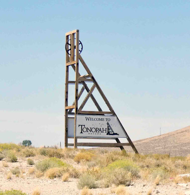
Moving on, we passed through Tonopah, and decided to get fuel there. Tonopah was to the north, and our final stop in Goldfield was to the south.
After that, the elegant Nevada Club Saloon opened in the building. Quite a posh clubroom, the bar was listed as one of the 10 best bars in the USA in 1910. Other tenants of the building included Miners Drug Store, A Cigar Shop, Sweldon Clothing Shop, and a variety of professional offices. It served Tonopah as the primary hub for business until the Great Depression in the early 1930’s paralyzed most all the businesses. It sat idle and vacant until it was purchased for conversion to apartments.
In 2011, the building was purchased again and renovated by Fred & Nancy Cline. This helped to ignite a revival in this historic mining town. Started in 2017, the project was no easy undertaking. It was complete renovation, and every part of the building was in some way brought back to life. After three years, the project was completed in 2020.
And just down the road we passed by the Clown Motel. For whatever reason, this motel is famous.
It's a clown-themed motel which has been referred to as "America's scariest motel". The building is located adjacent to the historic Tonopah Cemetery, where the father of the original owners is buried.
The 33-room Clown Motel was opened in 1985 by Leroy and Leona David in honor of their late father Clarence David whose collection of over 150 clown statues was used to decorate the property.
In 1995, Bob Perchetti bought the motel and operated it for 22 years until 2017 when he put the property up for sale for $900,000. Two years later the property was purchased by Vijay Mehar who appointed his former art director and family friend Hame Anand as CEO. Anand not only gave a new facelift to the motel but created a new identity as The World Famous Clown Motel. He also increased the collection from 600 clown statues to over 4,000 pieces of clown memorabilia.
And, frankly, I don't get this fear of clowns. I was never told I was supposed to be afraid of clowns. Stephen King's book, "It" probably adds to the scary lore surrounding clowns. For whatever reason, I was never convinced to be afraid of them even after reading the book.
We hoped we'd be done with these long straight roads, but no. This is Nevada for you.
From my window this morning, this is what I can see of the town of Goldfield.
Here's what I know about it: Goldfield was a boomtown in the first decade of the 20th century due to the discovery of gold – between 1903 and 1940, Goldfield's mines produced more than $86 million at then-current prices. Much of the town was destroyed by a fire in 1923, although several buildings survived and remain today, notably the Goldfield Hotel, the Consolidated Mines Building (the communications center of the town until 1963), and the schoolhouse. Gold exploration continues in and around the town today.
And here's something else: Wyatt and Virgil Earp came to Goldfield in 1904. Virgil was hired as a Goldfield deputy sheriff in January 1905. In April, he contracted pneumonia and, after six months of illness, died on October 19, 1905. Wyatt left Goldfield shortly afterward. And I always thought the Earps were around much earlier in our nation's history.
But here's something else, and a bit of a revelation to me. Goldfield reached a peak population around 20,000 people in 1906 and hosted a lightweight boxing championship match between Joe Gans and Oscar "Battling" Nelson (June 5, 1882 – February 7, 1954). He was a Danish-born American professional boxer who held the World Lightweight championship. He was also nicknamed "the Durable Dane". Here's a picture of him I found on Wikipedia.
Now here's the thing: When I was in graduate school, I had to write a paper about my family history, family stories, ancestry...that sort of thing. (In social work school, it was a way of understanding how our own history might bias our impressions of others.) I quizzed my mom and dad about notable people and stories, and my dad told me a story about a championship boxer by the name of "Battling Nelson." (Nelson is my maiden name.) He was related to our family. It was the one and only time I ever heard his name or his story...until now. It happened right here. Who woulda' thought?
He was elected to the International Boxing Hall of Fame in 1992. In 2016, award-winning biographer Mark Allen Baker published the first comprehensive biography of Nelson. Just now I checked Amazon, and f*ck a duck. There it is. Whoa.
Okay, so enough of this family lore. If you've enjoyed this post, you can thank Sadie for her careful editing.
It was extremely windy here yesterday, which made setting up kind of tricky. We have to pull out lots of stuff, and trying not to let things blow away is a challenge. The wind died down overnight, and the temperature cooled considerably. We're expecting to see a little rain and more cooling temperatures as we head north. We'll land in Reno, Nevada, today as our final destination.
Buckle up, my friends. It's time to head on down the road again.


8 comments:
In boxing, they say it's the punch you don't see coming that knocks you out. In the wider world, the reality we ignore or deny is the one that weakens our most impassioned efforts toward improvement. ~ Katherine Dunn
What? You didn't stop to see if the Clown Motel gift shop had any shot glasses or refrigerator magnets? Hopefully you'll get back to civilization soon. Makes you wonder why anyone would live out there.
Pat
The terrain looks like the Permian Basin area from Midland to Pecos, TX. The small houses are similar to most of the small towns in west Texas minus the mountains. The mountains we have are near Ft. Davis and Alpine, and of course Big Bend National Park.
Lots to read and digest in this post. I didnt know about the state of Utah plus surrounding areas was known as the great basin. Family stories are interesting, and yours has a famous boxer as a relation, how about that!
Now that is a very off the beaten path road you traveled, but it does have a lot of interesting history. Growing up in San Diego, a friend from early years met and married someone from Tonopah. I always thought she was a big city girl, but right after they married they moved to Tonopah and she has become a Nevada farm girl. I don't think I could live that far away from a good size town. Maybe if they had a really good quilt shop, but I doubt you found such in Tonopah, nor along this stretch of road.
Boy, there was a lot packed into this post - fun reading! I'll pass on the clown motel, thanks. I recall pulling onto the highway one morning in high school and having a cow walk in front of my car - I was able to brake, but boy, that's a big animal in front of a car! Ha!
It's always fun to read all the facts you manage to find to share with us. Our oldest son has been terrified of clowns his entire life - no idea why because it started long before he was reading Stephen King.
Lots of long road interrupted by a few interesting things along the way. Those kind of days are always tiring.
Post a Comment