Good morning, my friends. We had perfect weather for our second visit to Dinosaur National Monument. If you were following along when we made our trip last fall, you might remember our first visit. We were staying in Vernal, Utah, about 20 miles west of where we are now, and we visited the Quarry Exhibit, where we saw a rock wall two stories high embedded with more than 1,500 dinosaur bones.
On that trip, I'd wanted to take the Harpers Corner Scenic Drive. This is what I said in a previous blog post:
It would have meant leaving the park and driving on farther to Dinosaur, Colorado, where we could enter the park at a different spot. Then, the scenic drive itself was 31 miles one way. Adding it all up, we realized we were going to need to drive over 100 miles before we could return to Vernal, and so we decided to save that for a future trip...probably our Eclipse 2024 Trip next year.
And here we are! I love it when a plan comes together like that, don't you?
So we left the kitties in tandem napping position...
And we headed east again, crossing back into Colorado.
The visitor center is just inside the Colorado state line.
We were amused walking up to the visitor center entrance, seeing where these naughty critters had walked through wet concrete.
We picked up a guide book for the drive and one for the hike at the end. They were $1 each, and money well spent.
Our first stop was at the sunset overlook, where we could see this awesome view toward the south. I want you to notice the cliff to the right. You can see the layer of deep red mudstone sandwiched between two lighter-colored sandstones. This formation is known as Plug Hat Butte. From a different angle, it reminded an early traveler of a derby hat which inspired the name.
Heading back to the car, I spotted this guy as he flew by and landed some 100 yards away. I held real still, zoomed in a long way, and captured this image of a
Mountain Bluebird.
Also along our way both in the park and outside the park, we've seen veritable hordes of these "crickets." There are so many, they darken the roadway for a distance of about 20 feet, and then nothing. Then we'll find another patch. Since we've been seeing these for two days, it has given me some time to think about them. My guess is that these are the dreaded
Mormon crickets that have been
invading certain places, especially in Nevada. In fact, I avoided certain places in Nevada on our trip last fall because of the invasion. They can be different colors. The ones we’ve seen are red like this. They aren’t crickets at all, but katydids.
Driving on, we saw some spectacular views. Here, we were looking at the Echo Park overlook. That dirt/mud road goes some 12 miles to
Echo Park. We didn't want to take our truck down there yesterday. We are, however, outfitting our Jeep Wrangler so that we can tow it when we go to Alaska next year. Already we're making plans for other trips we can take with our now-towable Jeep, and this would be one of them.
Moving on, we could see the Yampa River below.
When we reached the end of the 31-mile road, we took the one mile (both directions) Harpers Corner Trail to the end. Along the way, we saw where the Chew Ranch was located on a small tributary of the Green River called Pool Creek. I've marked it with a red arrow in the image below.
The Chew family settled this pioneer cattle and sheep ranch around 1900. Today, it is maintained as an historic site. Below, I've zoomed in to get a better look at the buildings.
Before the Chew family came to the area, Pool Creek was the home of a colorful character named Pat Lynch. Pat wandered into the area in the early 1880's and for 20 years lived a hermit's life in caves and cabins along the lower Yampa Canyon and Pool Creek. The latter area is often called Pat's Hole after him. Here's a little more information about him:
Moving on, this is the west side of the trail, and the Green River below. This is Whirlpool Canyon formed by the surrounding rock rising to form the canyon, but also cut by the river. There was a plan to dam the river here, but protests shut down the project at this point. Instead a dam was built at another location on the Green River.
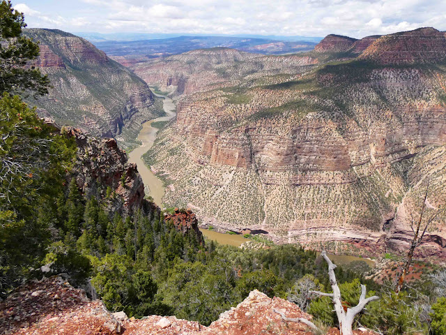
On the east side was this incredible view. This is the Yampa River. The Yampa River is the last major free-flowing tributary in the Colorado River System. On the left side of the image, you can see a fault. The formations have been raised up over millions of years.
Turning a little to my right from that spot, it looks like this:
Below, we could see rafters.
The forces that shaped these canyons are still in action. Rivers deepen their channels grain by grain; minor earth tremors occur daily in one place or another; and lands have risen or fallen, slowly but measurably, within historic times. We measure our history in years, but the planet measures time in millions of years, enough time for each tiny change to be multiplied over and over into major change.
The upturned layers of the "Mitten Park Fault" dramatize such change. Movement along the fault probably began with the uplifting of the region around 50 million years ago, and may have continued off and on almost to the present. Each shift, perhaps accompanied by a major earthquake, might have been only a few inches, but over the ages, many little shifts added up to a total displacement of about 3,000 feet from one side of the fault to the other. Here's another look at that fault.
Looking more to the right, we can see both rivers as they meet outside the frame. That part is hidden by bluffs.
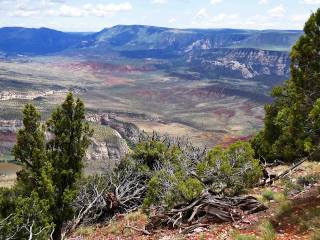
I included the picture below to show the contrast of the red rock with the green flora.
There were some blooming things along our hike as well. My phone tells me this is Erysimum capitatum (Western Wallflower...possibly my spirit flower).
This is a small cactus. It appears ready to bloom...or maybe it has already bloomed.
This next one is manzanita. It requires a very specific habitat. The only place within the monument with just the right combination of soil type, sun exposure, and moisture level to support it is at the Escalante Overlook, where I took this picture.
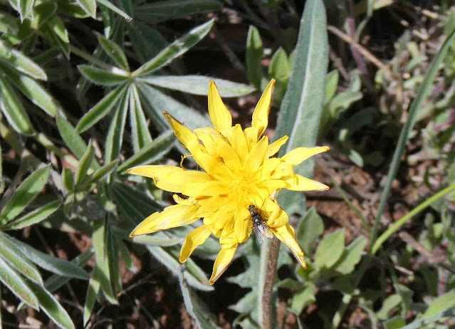
My phone tells me this is Agoseris (Mountain Dandelion).
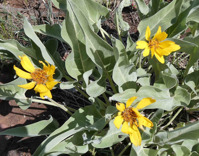
My phone tells me this is Wyethia (Giant Mule's Ears).
These are juniper berries. I know I've said this many times on this blog, but it bears repeating for those who weren't paying attention. Crack open one of these berries with your thumbnail, and it smells like gin. In fact, gin is made from juniper berries.
This is Desert Paintbrush. We have "Indian Paintbrush" in the northwest. It's flower is a little taller.
We only saw this in a few places, but as we drove back to the park entrance, we saw a whole field of them.
Okay, so I'm actually glad we ended up spending two days at this park. I would recommend it for anyone who is motivated to visit. The drive and hike took a whole day, and the previous visit took at least half a day. It's a unique and beautiful park, and well worth the trip.
Today we'll be moving along to Perry, Utah, just north of Ogden and Salt Lake City. We're making our way home now. Barring any unforeseen circumstances, we will be there on Thursday afternoon. For now, we're going to be driving, driving, driving. If we're up to it, we'll make one more stop at Shoshone Falls in Idaho, but only as a "get out, see it, and get back in" sort of stop.
Today's drive is about 250 miles, and so it's time to get ourselves around. We have another nice day of weather for today's drive. Always appreciated.


8 comments:
As a kid, I was pretty obsessed with dinosaurs and the day that my parents took me to Dinosaur National Park, I didn't think life could get any better. ~ Chelsea Clinton
Oh my, such beautiful scenery and amazing history. Thanks for sharing and inspiring as I have now added this to our bucket list. Absolutely gorgeous and you seem to be lucky to visit it at a perfect time with good weather and lovely flowers. You will be home soon, but I hope you enjoy the rest of your adventure.
Wow - those views are amazingly beautiful. The rock layers are so dramatic. Safe travels the next couple of days.
Amazing territory! Enjoy your trip home.
What a fun day of exploring, and so many pretty views once again. Lots of pretty flowers, too!
That's definitely a WOW of a drive. The canyons and views are really spectacular! Hope your long drive was very uneventful. To be home by Thursday is a lot of driving!
Talk about wow!! Your photos are incredible and I can only imagine how beautiful it must have been for real.
"Below there were rafters." Usually, one looks up to see rafters!
Post a Comment