
Good morning, my friends, and Hellooooooooo, Arizona.


We crossed over the Pine Valley Creek Bridge, which was later renamed the Nello Irwin Greer Memorial Bridge. This isn't my photo below. We couldn't see it like this. Where we crossed, it simply looked like flat highway.
%20(1).jpg)
(Image credit: By Original uploader was NicksGarage at en.wikipedia -
Wikimedia file, Public Domain, https://commons.wikimedia.org/w/index.php?curid=52980882)
The Google tells me that the northern span is 1,691 ft (515.4 m) long while the southern span is 1,741 ft (530.7 m) long. The two spans rise 450 ft (137.2 m) above the valley floor, placing it among the highest bridges in the United States. At the time of its construction, it was the first bridge constructed in the United States using the segmental balanced cantilever method. And if you're wondering what that means, The Google says that in segmental balanced cantilever construction the precast segments are transported to the bridge and placed and held at the right position before post-tensioning back to the rest of the bridge. A moving gantry with lifting capability for the heaviest segment is required to lift and hold the segment in position.
Clear as mud, right?
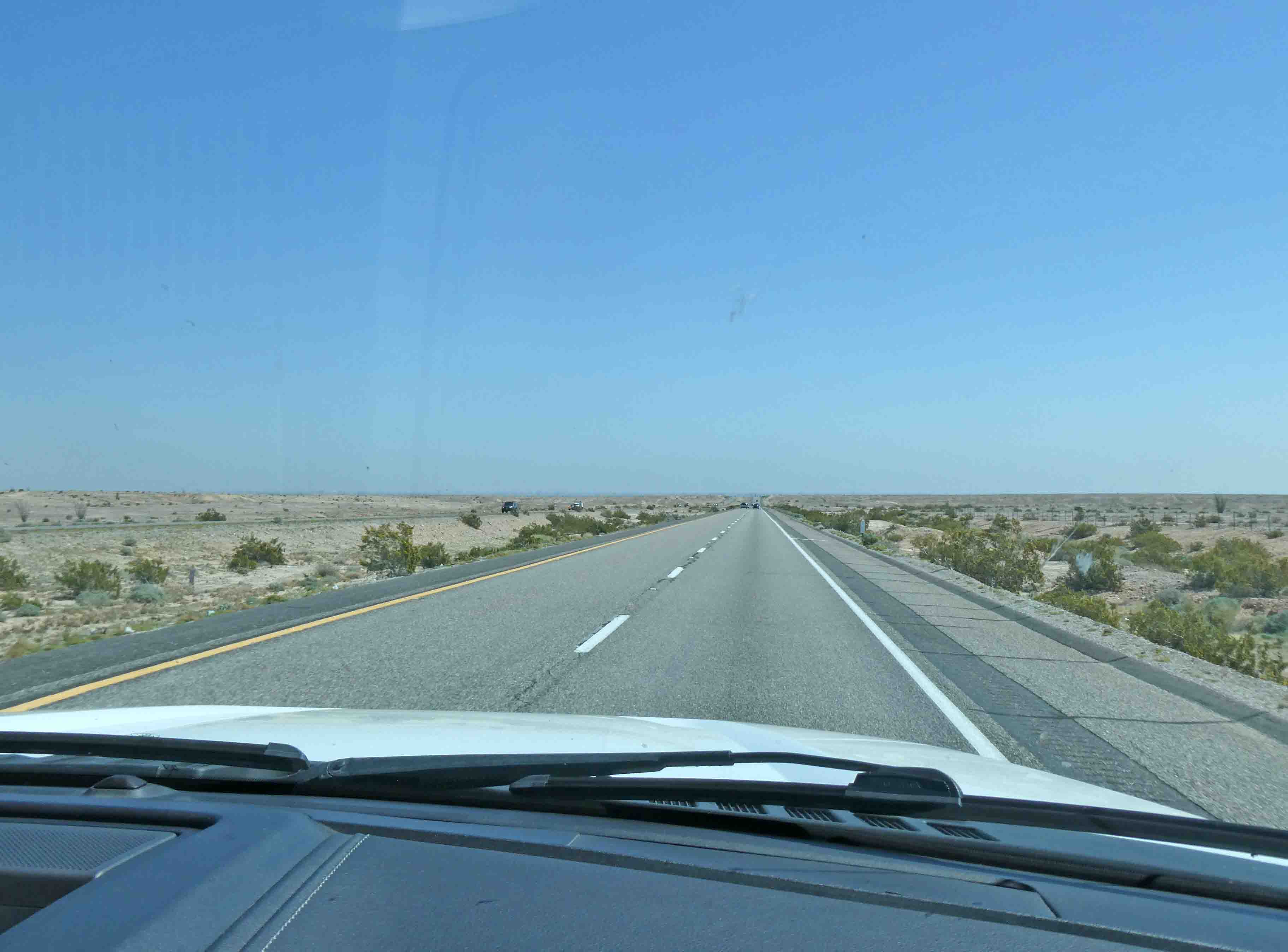
Moving along, the road stretched out straight and flat for a good part of the trip.


And it takes a lot of water to farm in the desert.

We passed by this enormous solar energy farm. This is the Tenaska Imperial Solar Energy Center. You can read more about it at that link I've given you. It's able to generate enough electricity to power approximately 44,000 California homes, and consists of nearly 2 million solar panels. All-in-all, it spans a 946-acre site in the southern part of Imperial County. Equipment for this is manufactured in Nebraska.

Continuing on, we passed by the Imperial Sand Dunes Recreation Area. I could see this from a distance, and it almost looked like snow.


We crossed over the Coachella Canal. Construction of the Coachella Canal began in the 1930s but was interrupted by World War II. After the war, work was resumed on the canal and deliveries of water began in the late 1940s. The canal was mostly earth-lined when it was first constructed, except for the last 38 miles, which were concrete-lined. Today, most of the canal is lined with concrete to prevent water loss from seepage. Grass eating fish are stocked in the canal to prevent water loss to aquatic vegetation.

Then we passed by this church that appears built on a berm. Something clicked in the back of my mind, and I was pretty sure I knew what this was. And since there were people walking around out there on a Thursday, I knew there was more going on here than worship services.


(Image credit: @david_k747 on Instagram)
One man, Jacques-André Istel, constructed a huge pyramid there, complete with a bronze plate. The plate, a disk set into the pyramid’s floor, marks what Istel considers to be the very middle of everything. The town itself was founded in 1986. It’s based on a children’s book he authored, called “Coe, The Good Dragon At The Centre Of The World”.

So passionate about this supposed center of the world, he decided to start a town, and name it after his beloved wife, Felicia. The town has a population of two… Mr. and Mrs. Istel. I guess it takes all kind of people to make a world.
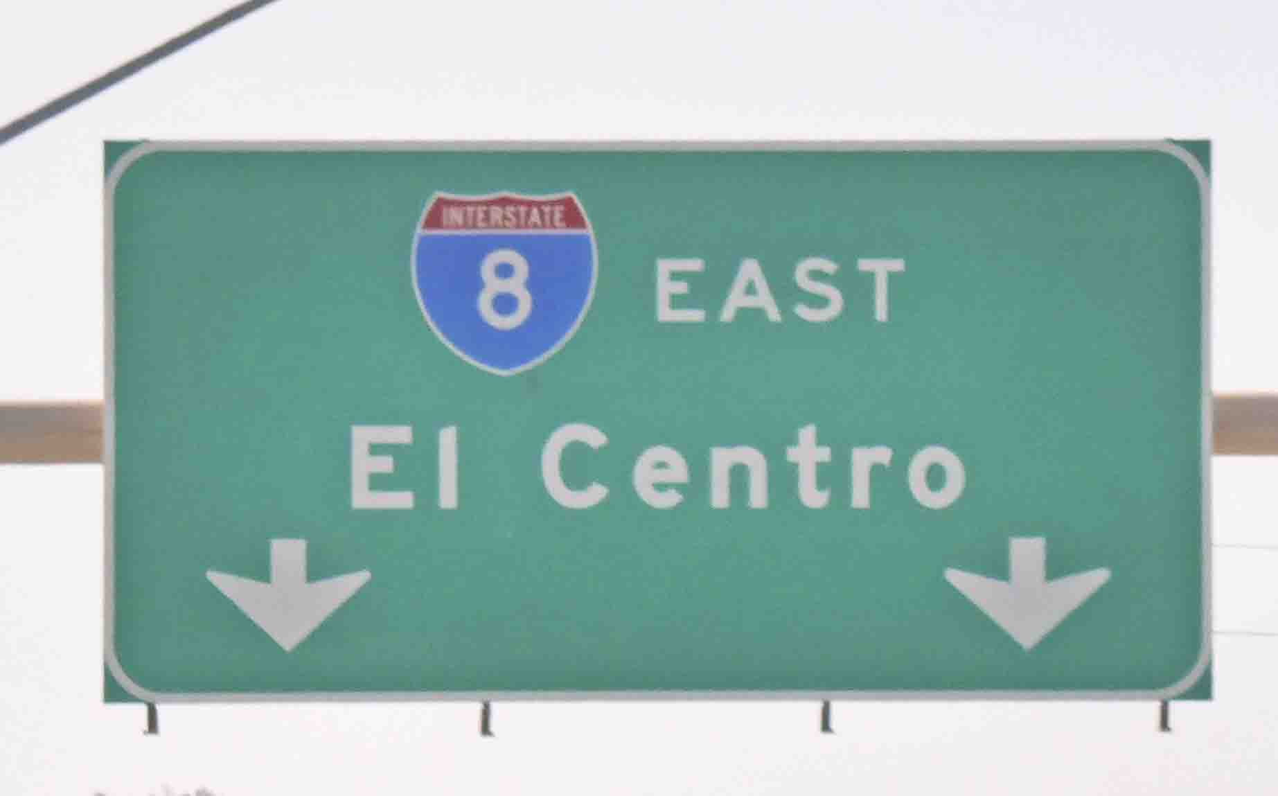
Okay, and now we can celebrate our entry into Arizona. We crossed this bridge over the Colorado River. The sign I've circled there marks the Arizona state line.


The catio below is for a different cat, but this is pretty fancy. I'm not sure how this travels. We can only think it must be disassembled. On the other hand, there are lots of folks living here, and another lot of them who are snowbirding from cold climates. We saw lots of license plates from Minnesota and Canada.

And that's about all I have for you today. We're just here for the night, and so we're ready to move on this morning. We'll end our day in Benson, Arizona, this afternoon, and we'll be stationary for three nights. The next RV park is the actual object of our desire. It has its own observatory. I don't know any more than that, so we'll learn more when we arrive.
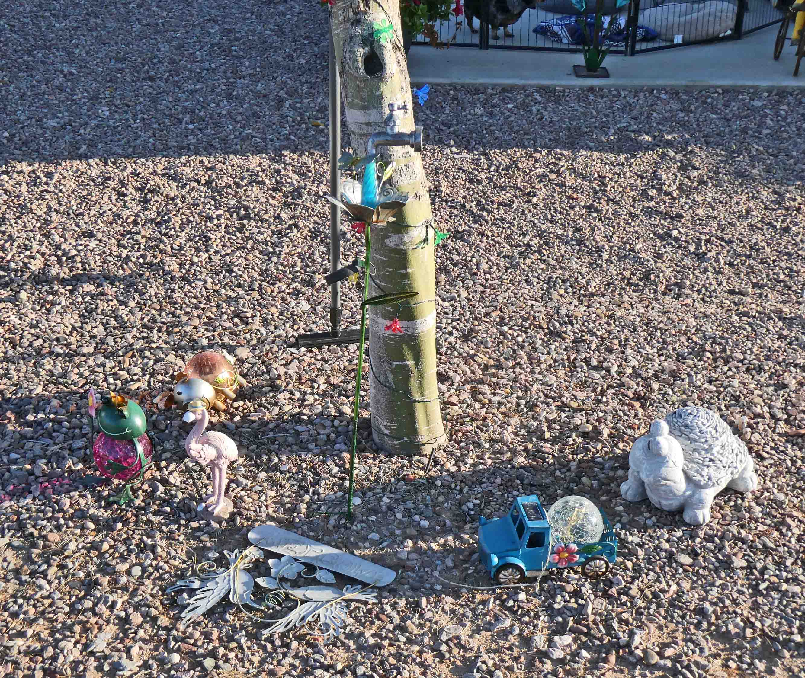
What follows are lots of pictures of some fun "garden art" we passed by in our walk around the park. I'm just posting pictures from here on. Take a look and enjoy. Or don't. I'm not trying to boss anyone around, but I think you'll enjoy seeing all this fun stuff. A woman informed us most of it came from one of the small border towns in Mexico.


8 comments:
I want you to be everything that's you, deep at the center of your being. ~ Confucius
The garden art really made me smile this morning. Safe travels!
I have a friend from guild who sold her house several years ago and now is a full time RV person. She travels with her cat (Mitzi) who likes to take walks on a leash like Smitty, and she spends most of the winter in Arizona. She's on the move this week, and is crossing Texas.
88 degrees and shorts - soak up some sun for me! That's quite the array of yard art. I like the roadrunners!
I live in Yuma so thank you for the pictures. Great article.
Lots of fun camp decor. Safe travels today.
Love the 'home is where you park it' sign and that wonderful giraffe on the trike. A population of two - wonder who is the mayor?
I think your post today deserves an award, although they are all great, this just hit over the top for both of us. We've driven the same road many times, including passing by the church, but never knew the background for it. Great research and thank you for taking the time to share with us. Wild flowers are also beautiful.
Oh I wish it was 88 degrees here. No shorts and T shirt, I'm wearing trousers, T shirt and long sleeved knitted jacket. Very interesting information about the church and surrounding area. I've never even considered where the middle would be.
Post a Comment