
Good morning, my friends! It's the last time I'll be writing to you from Idaho. This morning we'll head out for the Montana state line, stopping next in Dillon, Montana. We'll be there to see Bannack State Park, one of Montana's ghost towns. I don't know about you, but I loves me a good ghost town. Just now, I looked to see if there are any quilt shops there, and there are! I have a feeling I'm going to like this place.
For our final day in Stanley, we left the kitties snuggling down for their morning naps. Smitty traded places with Sadie. He had the back of the chair.


From there, we just started walking, walking walking. It wasn't long before Thompson Peak came into view. It's the tallest peak in the Sawtooths. The mountains were within our line of sight for most of the hike.

We'd been told that Fishhook Creek Trail was the "middle" trail from the Redfish Trailhead. This next sign confused me a little. The Bench Lakes trail took off to the left here. I was confused by the Marshall Lake notation. We didn't want to get on a hike that was going to take us too far afield from our original plan.

Continuing on for a bit, we found where the Marshall Lake trail went off toward the right, and then we were confident we were heading in the right direction, and on the right trail.

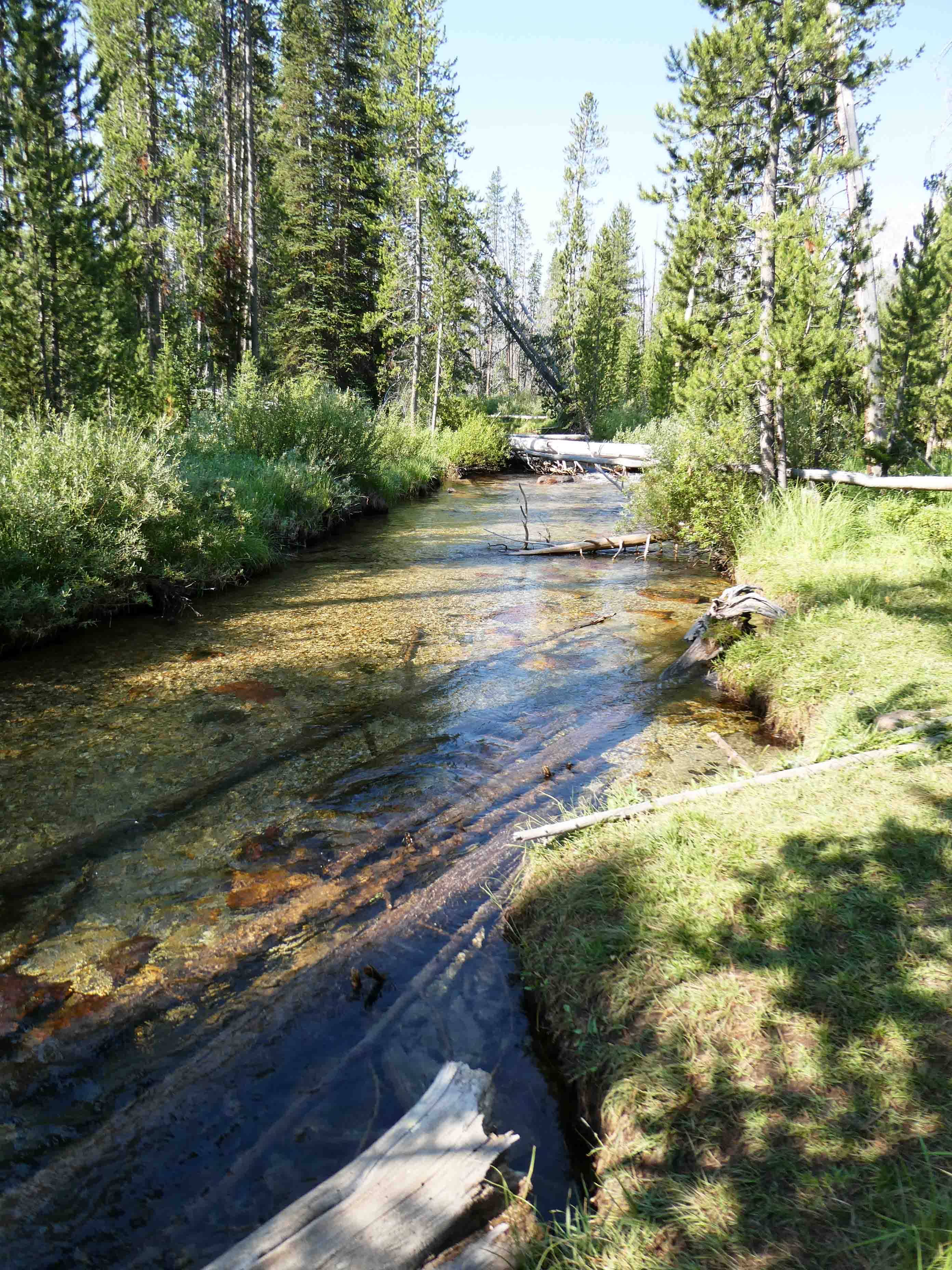
The trail was well worn, with a few rocks, but it was an easy hike. It was shady in spots and sunny in spots.

A good part of the distance was right alongside Fishhook Creek.


The chipmunks were tiny...not much larger than a mouse. They are incredibly fast, and so I feel lucky to have captured this one. Notice the white stripes on his face.


Got any Fritos? Doritos? Tostitos? Cheetos? C'mon, Man. Nothing?


("Black Squirrel" by tylerkaraszewski is licensed under CC BY 2.0.)
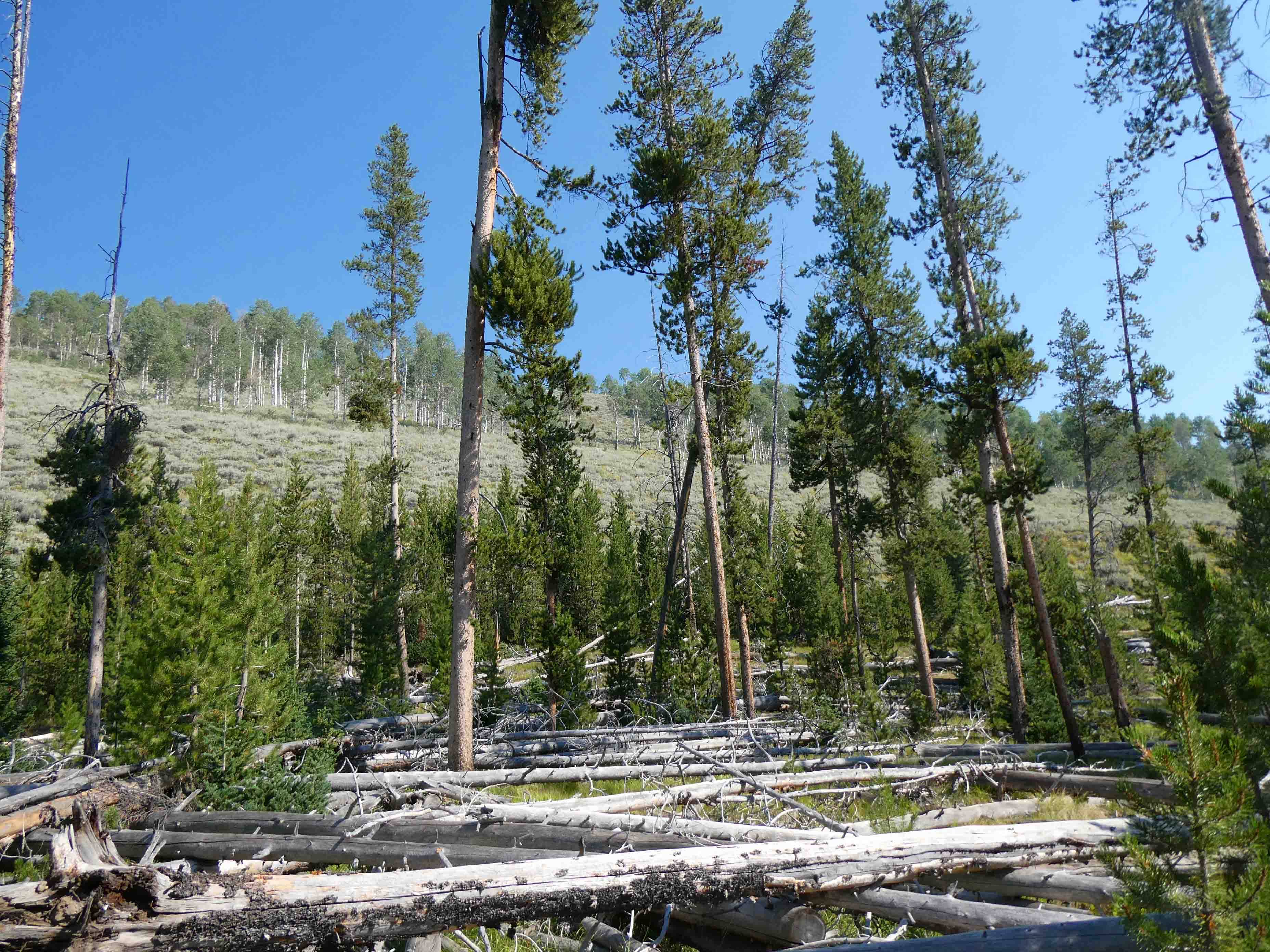
I took this next picture because I thought the terrain was interesting. This area obviously burned some time ago. There are plenty of fallen trees that have been there a long time. Other firs and pines have grown up. On the hillside above, you can see that the hillside was completely denuded at some point. Shrubs have grown up, and the aspens have taken over. It's one of the reasons we see so much fall color on the east coast, and relatively little in the west. If what I've been told is accurate, the settlers logged off all the evergreens near the Atlantic coast to build shelters and boats and whatever else they needed. In their place, the deciduous trees grew up first, and that is what has happened here. Take away the shade from the evergreens, and the deciduous trees get a chance to thrive. No fall color yet. These are all still green.


I tried my best to capture him with his wings open, but no dice.

We also saw plenty of these grasshoppers. They make a loud snapping sound that can be rather startling if they're right beside you. We've had plenty pelting our windshield as we drive down the road.


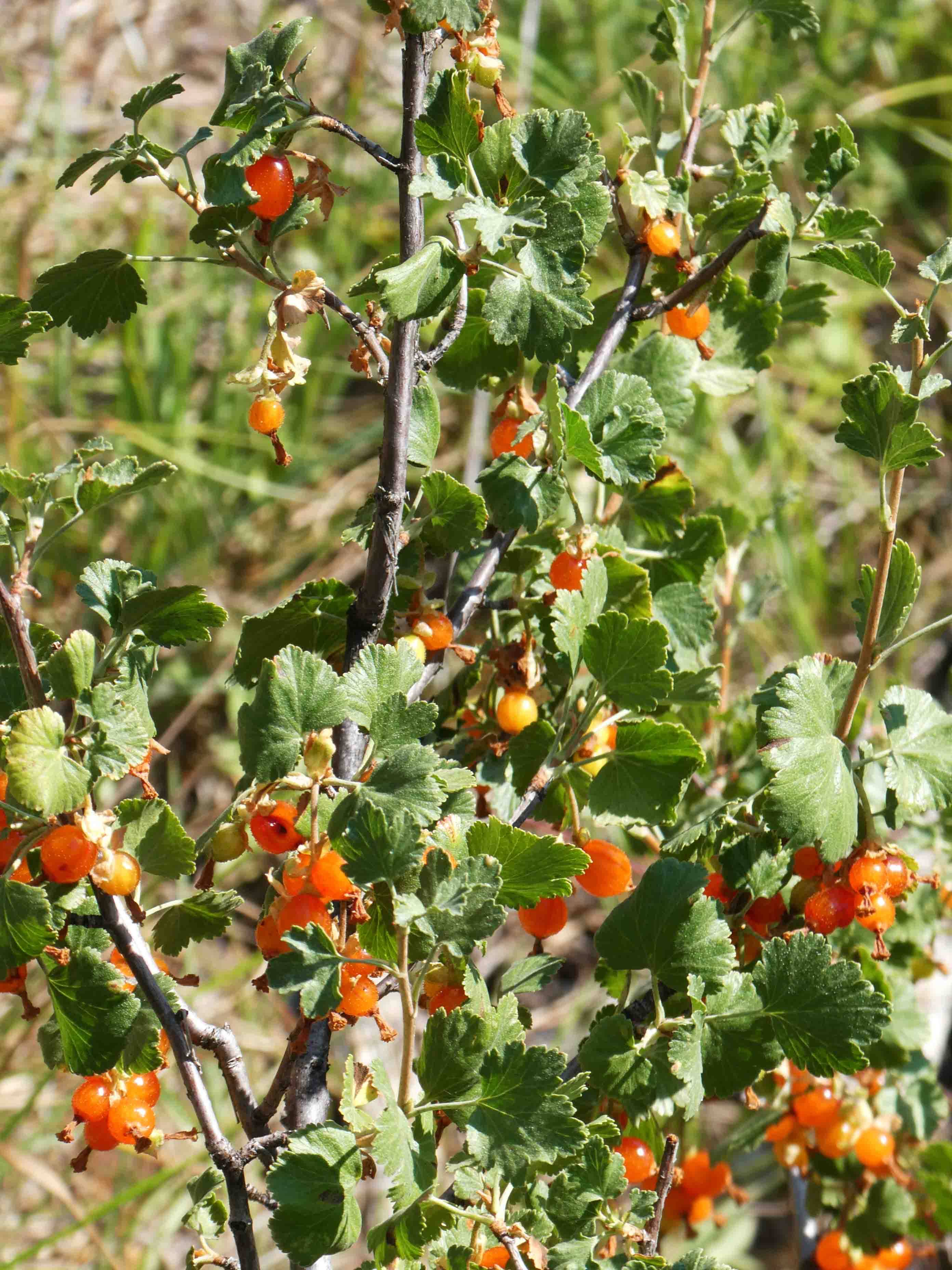
These are wild red currants.


The Sheepeater Tribe was the first known group of inhabitants in the area. This group of Native Americans excelled at hunting and would search for goats, sheep, elk, and deer in the summer months. The capability to kill such prized game offered the tribe the power to trade furs and meat at high value to other groups.As more settlers, trappers, and miners began to visit the area, conflict with the Sheepeaters and other Native American tribes in Idaho became unavoidable. Pioneers explored further into Native American territory, becoming more nervous of these interactions, while threatened tribes moved further and further into the mountains for safety. Then, in 1879, five Chinese miners were murdered on Loon Creek, near the Middle Fork of the Salmon River, and the blame fell on the Tribe. From this point, interactions between the settlers and natives descended into chaos known as the “Sheepeater Wars,” which ended with the surrender of the remaining 51 Sheepeaters.You can see the remnants of a rock shelter used by the Sheepeater Tribe located near Little Redfish Lake, over a wooden bridge crossing Redfish Lake Creek at the lake’s outlet.
It took us a bit to find it with a couple of false starts. Eventually, we located the bridge.


Okay, and that was the end of our day. We headed back to the RV to relax. I iced my knees, although they were feeling pretty good. We'd walked around 6 miles altogether, and I accumulated 14,000 steps and 15 floors. Since I hadn't met my step goal the last two days, I was feeling as if I'd made up for some lost steps.
This morning we'll head out early. It will be a long drive ahead. I'm expecting internet at the other end, but it's never guaranteed. Hopefully, I'll meet you on the other side. With the promise of quilt shops, my debit card is heating up.
9 comments:
Happiness is a butterfly, which when pursued, is always just beyond your grasp, but which, if you will sit down quietly, may alight upon you. ~ Nathaniel Hawthorne
What a pretty hike with those mountain views! And yay for finding some quilt shops!
Lovely photos as always! What a pretty and serene location! The black squirrels reminds me of a golf course we played many years ago, although I can't remember where. Possibly somewhere in Colorado? The tee box markers were little black squirrels to honor the little critters that were so plentiful in that location.
Thank you so much. I read every word and so enjoyed the views, flowers and wildlife.
I'm in awe of those snow capped mountain peaks rising so majestically!
Wow, great pictures! I just love Idaho and its scenery. A couple of your photos would make great Bob Ross-type paintings (if the trees were happy, of course!)
Beautiful.
I loved the pictures of the Sawtooth Mountains. I grew up in this area and would love to get back and visit more often. When I lived near Stanley, the population was 99!
I always enjoy reading the bits of history you include in your posts. And you really should think about taking some of your photos and turning them into greeting cards.
Post a Comment