Good morning, my friends! I'm so happy to be sipping my coffee while we chat this morning. It's been a while since we've spent a morning together. Today I'll be writing the first of three time traveling posts, backing up a full week to when we took a drive through Titus Canyon. But first...let's back up to a day earlier when we made our way from Pahrump to Death Valley, a drive of about two hours. The colors of Death Valley begin to appear fairly quickly along this road. It's a pretty drive.
Just before approaching the entrance to the park, there are deep ravines with lots of color.
And...here we are. This is a new thing, I've realized. Maybe people have been doing this for years, but it seems more common nowadays with even more people visiting the parks. It's hard to get a good drive-by shot without people climbing all over the sign.
Smitty was happy to finally have the morning sun on his hammock.
That was Monday. The weather was expected to turn cold and windy, and so we wasted no time getting out and doing some sight-seeing on Tuesday. We were using this book as our guide, and much of the information I'll give you here comes from this book:
Explorers...yeah, that's us. We were staying at the Sunset Campground just across from the Furnace Creek Visitor Center. I caught this sign for Furnace Creek. Note the elevation: 190 feet *below* sea level.
Okay, so heading northwest from the Furnace Creek Campground, we were on the main highway heading toward Daylight Pass Road.
We had a good view of
Corkscrew Peak as we went. It's possible to hike to the top, but we're much too old for that sort of thing. You understand, right?
There is a sign warning of desert tortoises on this road. We noticed the park service (or someone) has built a little barrier along the side of the road to prevent them from wandering out onto the highway. Things like this give me hope for humanity.
As I've mentioned before, when I see a road stretching out before us like this, I also hear my mother's voice saying, "There goes the road." This road leads to Rhyolite ghost town and Beatty, Nevada.
It was about a 15 mile drive after turning onto Daylight Pass Road to reach the turn-off for Titus Canyon Road. Here's a little information about what we're just about to do.
I took a picture of all the safety warnings, but it was mostly cut-off on the right-hand side. What can I say? Just tread carefully as we go, my friends. And be sure to bring a bottle of water. You could die out here.
The road started out easy enough. It's maintained, but rugged. One could travel this road without high clearance or four-wheel drive, but it was a rough road even in our truck.
Here's a pano of the area from where we were parked. It's very isolated. We would leave the park and the state of California and then re-enter again as we ended our trek.
The bands of color in the hillside are the most interesting parts of the beginning of the road. We would be traveling 26.1 miles before we were finished.
Looking out across the canyon, we could see the road we would be traveling.
We were climbing a hill on an
alluvial fan. Much of what is seen in Death Valley consists of alluvial fans. It is the nature of erosion and a testament to the age of these rock formations.
Below, we're looking at an erosional remnant of a thick layer of volcanic ash that blanketed the countryside during a tremendous eruption 11 million years ago (about the time I celebrated my first birthday). The eruption took place near Yucca Flat, within the Nevada Test Site. Our book informs us that the prominent rock layers, from bottom to top, are while volcanic ash, greenish steam-deposited siltstone, a pale layer of sandstone, and a rough mountaintop of volcanic ash erupted from Monotony Valley, Nevada.
The road crosses from Nevada into California near here. The rocks throughout this area go by the general name of "Grapevine Volcanics," but they actually represent separate episodes of volcanism with different source areas.
Winding around a sharp turn, we came across this outcrop of basalt. This is a volcanic "neck," the conduit that fed magma to a volcano that has been completely eroded away.
There are small mines visible south of the road here, and we stopped to have a look, hiking out a short distance to a pile of mine tailings.
There was evidence of wild burros here. (Yes, actually, I did take a picture of burro sh*t. I knew you'd want to see it.)
This is the abandoned mine shaft we found there. It's gated and locked for safety, but we could still peer inside.
I balanced the camera on the gate and was able to capture this shot inside, despite the low light.
Turning around, you can see where our truck is parked for scale and to get an idea of the isolation.
Moving on, we could get a glimpse of the Leadfield ghost town ahead. Looking a little to the right of center and lower, you can see one of the structures there.
Another mile or so and we were at the ghost town. We got out and did some exploring here, and I have lots of pictures. I'll cover that in my next time traveling post.
For now, let's just keep going to the petroglyphs.
As far as petroglyphs go, we've seen better ones. These were very old, and they'd been vandalized by modern travelers, unfortunately.
To the left of the sign, we saw this:
It isn't surprising that the petroglyphs would appear here because we were approaching Klare Spring. You can
read a little more about this right here. For now, just know that it is the only reliable source of water in all of the Titus Canyon drainage system, and so it is critical for wildlife. Where there is water, there are often petroglyphs.
It bubbles up from the
Titus Canyon Fault. In fact, most of Titus Canyon follows a remarkably straight line defined by this fault. We located the source, indicated with a red arrow in the image below.
Moving on, we were getting ready to enter the most narrow part of the canyon, barely wide enough for a vehicle to pass. Along the way, we saw these little cactus, about the size of softballs. These are
Cottontop Cactus, and among the few living things we saw on our drive.
Here, I was trying to capture the scale, but found it difficult to get both our truck and the height of the cliffs in the same image.
Here's another attempt a little farther on. You can see the canyon is narrowing.
Pretty much the whole drive along here was in a "wash," and as we approached the canyon's end, the road became narrower and narrower and took an interesting zig-zagging course. This area is known as Titus Canyon Narrows and the vertical cliffs tower several hundred feet high. Here,
Cambrian-age limestones have been twisted, folded, and broken by mountain building. Mosaics of shattered blocks healed by recrystallized white calcite make up many of the cliff walls. The rocks are around 500 million years old. You can see a good example in the image below.
Shortly after that, we suddenly burst free from the narrows and we were again on an alluvial fan in the national park.
It was National Margarita Day and we found ourselves without limes. We were close to
Stovepipe Wells here, and so we decided to see if we could find some at their little market. Along the way, we enjoyed a good view of the
Mesquite Dunes.
We were unsuccessful finding limes there, but we were able to find some at the market in Furnace Creek. As we headed back to our campsite, we could see a dust storm approaching. Yikes!
We had a similar storm the afternoon of the following day, but the weather improved after that. The wind wasn't steady, but there were strong gusts, and the dust seeped in through the windows. It wasn't noticeable, except that we'd just run around the RV with a dust mop that morning. Probably, we brought this on ourselves...like bringing on a rain storm right after washing the car.
Sadie has taken up residence on the shelf of Mike's side of the closet. She's very comfortable there, thank you, and Smitty is too big to bother her there.
Oh well...it just means more catio time for him.
The dust storm passed in about an hour, and we enjoyed the hills to the east lighting up red in the setting sun.
Turning around, there was raking light coming through the clouds, although it doesn't show well in the image below.
The temperature cooled significantly overnight, and we awoke to snow halfway down the mountains to the west.
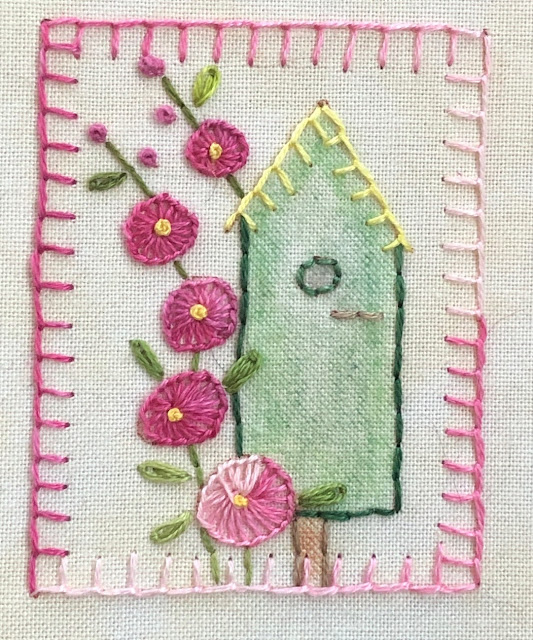
Okay, so let's just travel back to the present now. I'll have two more time-traveling posts before we're finished. For now, I want to catch you up on all the hand-sewing I've been doing. The inchies are finished now, except for the two larger motifs. I've finished one of those and I'm working on the other. I'll show it when I've finished the whole thing. As for the inchies, here are the last of them:
I kind of like this next one with the inside-out buttonhole stitch flowers.
When I had 25 finished, I made this little collage. My collage-maker won't let me do more than 20 photos, and so I tacked the bottom row on.
After that, there were two more.
And, this being March 1st, I'm setting as my goal to sew the inchies into a completed quilt top for March's
Oh, but that's not all. I've finished all the blackwork baskets now too. Here's Basket #8...
And Basket #9...
And here are all nine together:
I have some pretty fabrics at home I'll use when I sew this into a finished quilt top. I'm kind of excited to get started on it.
Okay, so that's all I have for you this morning. We're heading off to see the
Marietta Wild Burro Range this morning. Fingers crossed we actually see some wild burros. If there's time, I'll be back this afternoon with another post...I'm trying to catch up. If not, I'll be right back here tomorrow with the latest from the Traveling Three Cats Ranch.